
ULN Ulaanbaatar, Mongolia - Earthquake Result Viewer
| ||||||||||||||||||
| ||||||||||||||||||
| ||||||||||||||||||
|
Signal To Noise
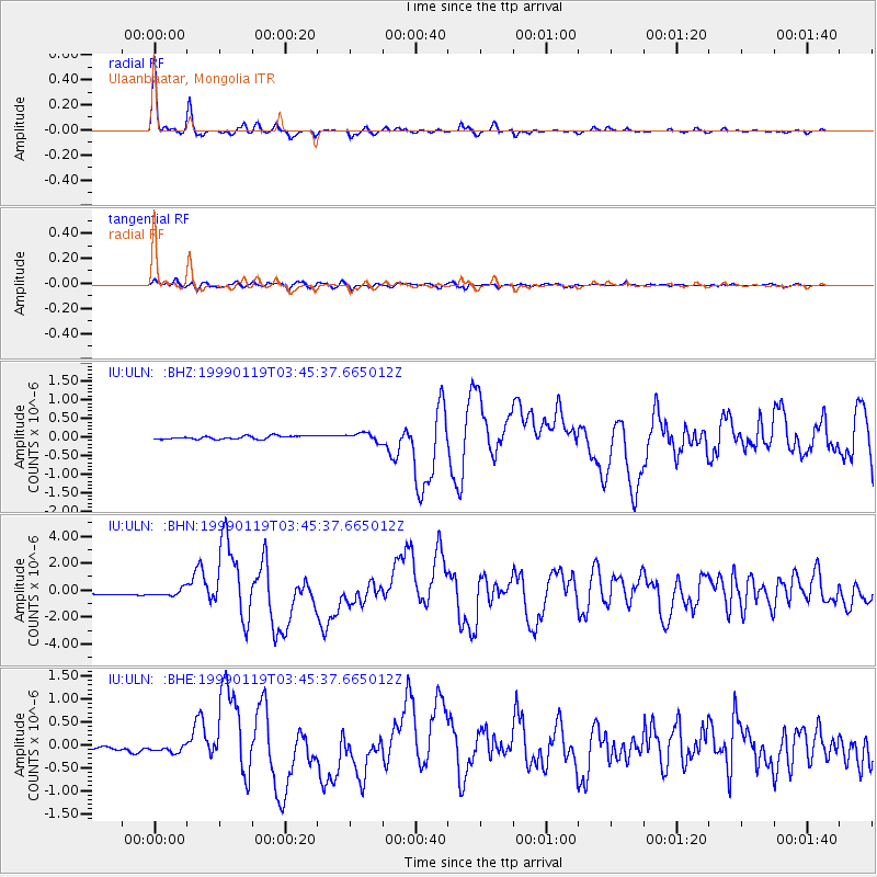
| Channel | StoN | STA | LTA |
| IU:ULN: :BHN:19990119T03:45:37.665012Z | 1.7084376 | 2.6844552E-7 | 1.5712925E-7 |
| IU:ULN: :BHE:19990119T03:45:37.665012Z | 0.96879494 | 8.598829E-8 | 8.875799E-8 |
| IU:ULN: :BHZ:19990119T03:45:37.665012Z | 2.6897457 | 1.1352934E-7 | 4.2208207E-8 |
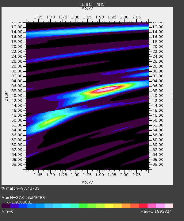
| Arrivals | |
| Ps | 5.4 SECOND |
| PpPs | 16 SECOND |
| PsPs/PpSs | 21 SECOND |

