You are here: Home > Network List > AZ - ANZA Regional Network Stations List
> Station LVA2 AZ.LVA2 > Earthquake Result Viewer
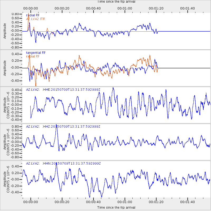
LVA2 AZ.LVA2 - Earthquake Result Viewer
*The percent match for this event was below the threshold and hence no stack was calculated.
| Earthquake location: |
Near Coast Of Guatemala |
| Earthquake latitude/longitude: |
13.3/-90.2 |
| Earthquake time(UTC): |
2015/07/09 (190) 13:25:54 GMT |
| Earthquake Depth: |
48 km |
| Earthquake Magnitude: |
5.6 MWW, 5.6 MWC |
| Earthquake Catalog/Contributor: |
NEIC PDE/NEIC COMCAT |
|
| Network: |
AZ ANZA Regional Network |
| Station: |
LVA2 AZ.LVA2 |
| Lat/Lon: |
33.35 N/116.56 W |
| Elevation: |
1435 m |
|
| Distance: |
31.2 deg |
| Az: |
314.231 deg |
| Baz: |
123.55 deg |
| Ray Param: |
$rayparam |
*The percent match for this event was below the threshold and hence was not used in the summary stack. |
|
| Radial Match: |
52.188087 % |
| Radial Bump: |
400 |
| Transverse Match: |
50.55324 % |
| Transverse Bump: |
400 |
| SOD ConfigId: |
7422571 |
| Insert Time: |
2019-04-19 17:46:31.119 +0000 |
| GWidth: |
2.5 |
| Max Bumps: |
400 |
| Tol: |
0.001 |
|
Signal To Noise
| Channel | StoN | STA | LTA |
| AZ:LVA2: :HHZ:20150709T13:31:37.592999Z | 1.1801443 | 1.7064144E-7 | 1.445937E-7 |
| AZ:LVA2: :HHN:20150709T13:31:37.592999Z | 0.40442756 | 7.243394E-8 | 1.7910239E-7 |
| AZ:LVA2: :HHE:20150709T13:31:37.592999Z | 0.9450822 | 1.3021335E-7 | 1.3777992E-7 |
| Arrivals |
| Ps | |
| PpPs | |
| PsPs/PpSs | |


