You are here: Home > Network List > AZ - ANZA Regional Network Stations List
> Station SMER AZ.SMER > Earthquake Result Viewer
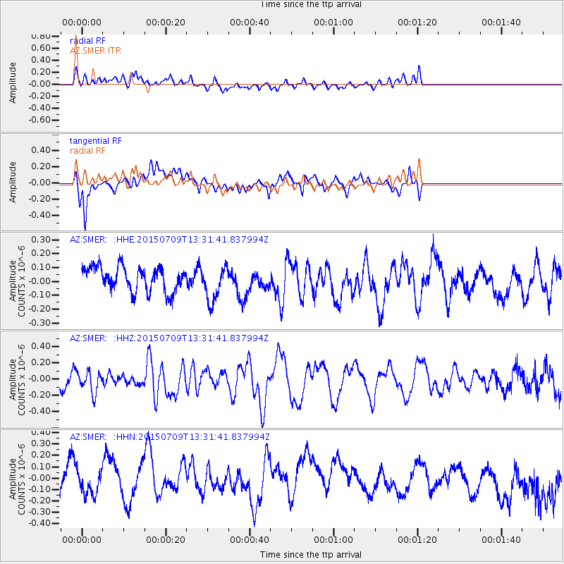
SMER AZ.SMER - Earthquake Result Viewer
*The percent match for this event was below the threshold and hence no stack was calculated.
| Earthquake location: |
Near Coast Of Guatemala |
| Earthquake latitude/longitude: |
13.3/-90.2 |
| Earthquake time(UTC): |
2015/07/09 (190) 13:25:54 GMT |
| Earthquake Depth: |
48 km |
| Earthquake Magnitude: |
5.6 MWW, 5.6 MWC |
| Earthquake Catalog/Contributor: |
NEIC PDE/NEIC COMCAT |
|
| Network: |
AZ ANZA Regional Network |
| Station: |
SMER AZ.SMER |
| Lat/Lon: |
33.46 N/117.17 W |
| Elevation: |
355 m |
|
| Distance: |
31.7 deg |
| Az: |
313.865 deg |
| Baz: |
122.904 deg |
| Ray Param: |
$rayparam |
*The percent match for this event was below the threshold and hence was not used in the summary stack. |
|
| Radial Match: |
39.377773 % |
| Radial Bump: |
400 |
| Transverse Match: |
60.3515 % |
| Transverse Bump: |
400 |
| SOD ConfigId: |
7422571 |
| Insert Time: |
2019-04-19 17:46:31.898 +0000 |
| GWidth: |
2.5 |
| Max Bumps: |
400 |
| Tol: |
0.001 |
|
Signal To Noise
| Channel | StoN | STA | LTA |
| AZ:SMER: :HHZ:20150709T13:31:41.837994Z | 1.8832015 | 1.2915233E-7 | 6.858126E-8 |
| AZ:SMER: :HHN:20150709T13:31:41.837994Z | 0.63756865 | 8.3450985E-8 | 1.308894E-7 |
| AZ:SMER: :HHE:20150709T13:31:41.837994Z | 1.4660102 | 1.248673E-7 | 8.517491E-8 |
| Arrivals |
| Ps | |
| PpPs | |
| PsPs/PpSs | |


