You are here: Home > Network List > TA - USArray Transportable Network (new EarthScope stations) Stations List
> Station L04D Klamath Falls, OR, USA > Earthquake Result Viewer
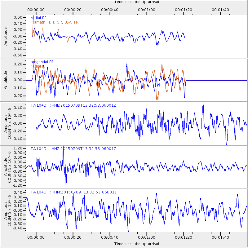
L04D Klamath Falls, OR, USA - Earthquake Result Viewer
*The percent match for this event was below the threshold and hence no stack was calculated.
| Earthquake location: |
Near Coast Of Guatemala |
| Earthquake latitude/longitude: |
13.3/-90.2 |
| Earthquake time(UTC): |
2015/07/09 (190) 13:25:54 GMT |
| Earthquake Depth: |
48 km |
| Earthquake Magnitude: |
5.6 MWW, 5.6 MWC |
| Earthquake Catalog/Contributor: |
NEIC PDE/NEIC COMCAT |
|
| Network: |
TA USArray Transportable Network (new EarthScope stations) |
| Station: |
L04D Klamath Falls, OR, USA |
| Lat/Lon: |
42.22 N/122.30 W |
| Elevation: |
1437 m |
|
| Distance: |
40.0 deg |
| Az: |
322.175 deg |
| Baz: |
126.517 deg |
| Ray Param: |
$rayparam |
*The percent match for this event was below the threshold and hence was not used in the summary stack. |
|
| Radial Match: |
68.178345 % |
| Radial Bump: |
377 |
| Transverse Match: |
57.863167 % |
| Transverse Bump: |
400 |
| SOD ConfigId: |
7422571 |
| Insert Time: |
2019-04-19 17:49:56.301 +0000 |
| GWidth: |
2.5 |
| Max Bumps: |
400 |
| Tol: |
0.001 |
|
Signal To Noise
| Channel | StoN | STA | LTA |
| TA:L04D: :HHZ:20150709T13:32:53.06001Z | 2.3337169 | 2.959967E-7 | 1.2683489E-7 |
| TA:L04D: :HHN:20150709T13:32:53.06001Z | 0.6724836 | 9.760737E-8 | 1.4514461E-7 |
| TA:L04D: :HHE:20150709T13:32:53.06001Z | 1.233914 | 1.2005322E-7 | 9.729463E-8 |
| Arrivals |
| Ps | |
| PpPs | |
| PsPs/PpSs | |


