ULN Ulaanbaatar, Mongolia - Earthquake Result Viewer
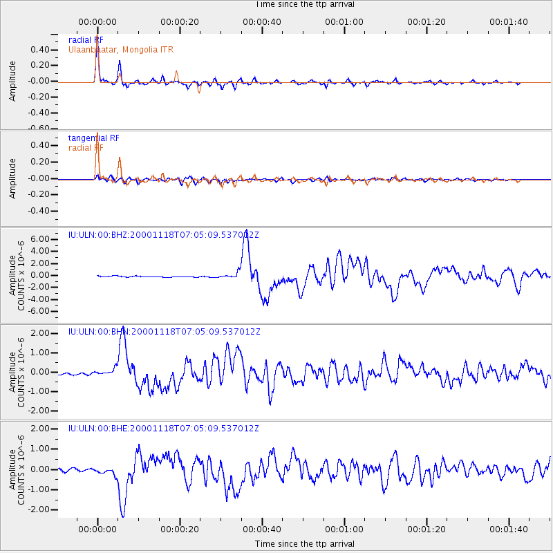
Earthquake location: New Britain Region, P.N.G.
Earthquake latitude/longitude: -5.2/151.8
Earthquake time(UTC): 2000/11/18 (323) 06:54:58 GMT
Earthquake Depth: 33 km
Earthquake Magnitude: 6.2 MB, 6.6 MS, 6.8 MW, 6.8 MW
Earthquake Catalog/Contributor: WHDF/NEIC
Network: IU Global Seismograph Network (GSN - IRIS/USGS)
Station: ULN Ulaanbaatar, Mongolia
Lat/Lon: 47.87 N/107.05 E
Elevation: 1610 m
Distance: 65.8 deg
Az: 328.712 deg
Baz: 129.815 deg
Ray Param: 0.05796764
Estimated Moho Depth: 37.5 km
Estimated Crust Vp/Vs: 1.91
Assumed Crust Vp: 6.642 km/s
Estimated Crust Vs: 3.473 km/s
Estimated Crust Poisson's Ratio: 0.31
Radial Match: 97.38859 %
Radial Bump: 284
Transverse Match: 88.88088 %
Transverse Bump: 400
SOD ConfigId: 3744
Insert Time: 2010-03-03 16:14:43.021 +0000
GWidth: 2.5
Max Bumps: 400
Tol: 0.001

Signal To Noise

ChannelStoNSTALTA
IU:ULN:00:BHN:20001118T07:05:09.537012Z2.69203951.8998642E-77.057342E-8
IU:ULN:00:BHE:20001118T07:05:09.537012Z2.60117221.8041577E-76.9359416E-8
IU:ULN:00:BHZ:20001118T07:05:09.537012Z6.26574375.371729E-78.5731706E-8
Arrivals
Ps5.4 SECOND
PpPs16 SECOND
PsPs/PpSs21 SECOND