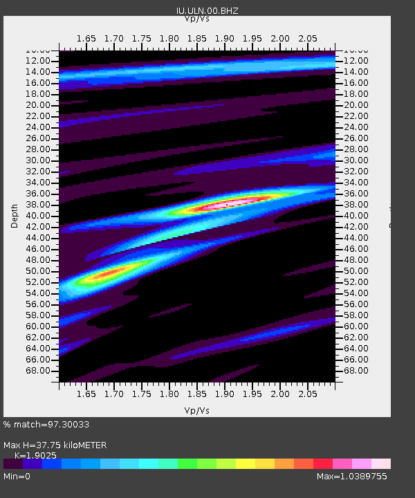
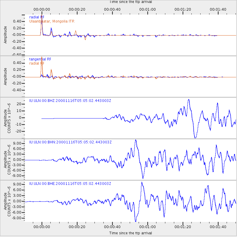
ULN Ulaanbaatar, Mongolia - Earthquake Result Viewer

Earthquake location: New Ireland Region, P.N.G.
Earthquake latitude/longitude: -4.0/152.2
Earthquake time(UTC): 2000/11/16 (321) 04:54:56 GMT
Earthquake Depth: 33 km
Earthquake Magnitude: 6.0 MB, 8.2 MS, 8.0 MW, 8.0 ME
Earthquake Catalog/Contributor: WHDF/NEIC
Network: IU Global Seismograph Network (GSN - IRIS/USGS)
Station: ULN Ulaanbaatar, Mongolia
Lat/Lon: 47.87 N/107.05 E
Elevation: 1610 m
Distance: 65.0 deg
Az: 328.228 deg
Baz: 128.73 deg
Ray Param: 0.058524825
Estimated Moho Depth: 37.75 km
Estimated Crust Vp/Vs: 1.90
Assumed Crust Vp: 6.642 km/s
Estimated Crust Vs: 3.491 km/s
Estimated Crust Poisson's Ratio: 0.31
Radial Match: 97.30033 %
Radial Bump: 178
Transverse Match: 85.35196 %
Transverse Bump: 400
SOD ConfigId: 3744
Insert Time: 2010-03-03 16:14:48.412 +0000
GWidth: 2.5
Max Bumps: 400
Tol: 0.001

Signal To Noise

ChannelStoNSTALTA
IU:ULN:00:BHN:20001116T05:05:02.443003Z0.849465377.175489E-88.447064E-8
IU:ULN:00:BHE:20001116T05:05:02.443003Z0.94432058.099124E-88.5766686E-8
IU:ULN:00:BHZ:20001116T05:05:02.443003Z0.52836981.0074761E-71.9067633E-7
Arrivals
Ps5.3 SECOND
PpPs16 SECOND
PsPs/PpSs21 SECOND