
ULN Ulaanbaatar, Mongolia - Earthquake Result Viewer
| ||||||||||||||||||
| ||||||||||||||||||
| ||||||||||||||||||
|
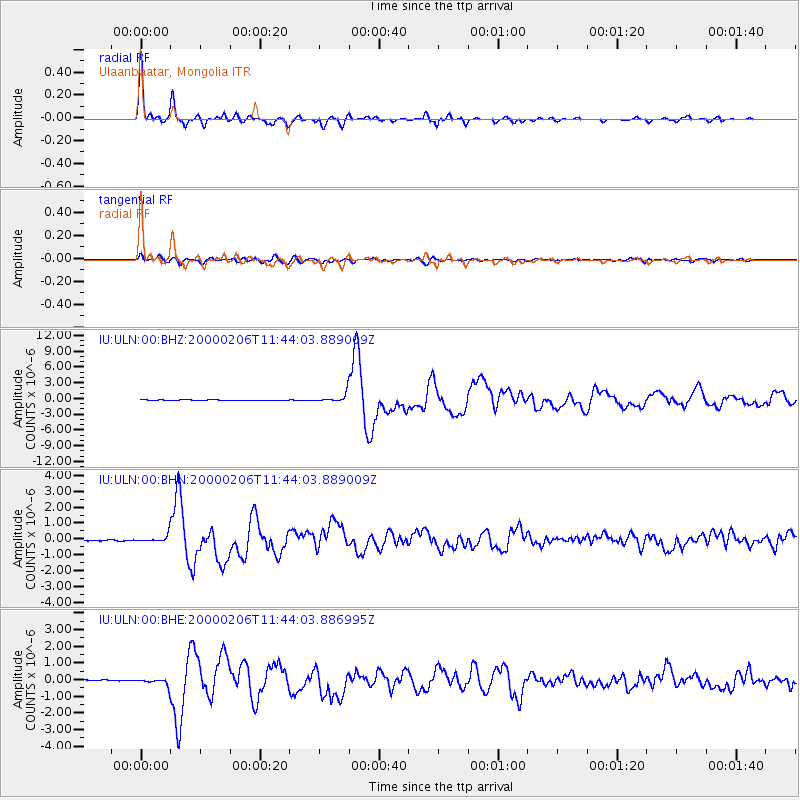
Signal To Noise
| Channel | StoN | STA | LTA |
| IU:ULN:00:BHN:20000206T11:44:03.889009Z | 5.6693654 | 2.3870805E-7 | 4.2104897E-8 |
| IU:ULN:00:BHE:20000206T11:44:03.886995Z | 6.014325 | 2.0852009E-7 | 3.467057E-8 |
| IU:ULN:00:BHZ:20000206T11:44:03.889009Z | 14.03606 | 8.339067E-7 | 5.9411736E-8 |
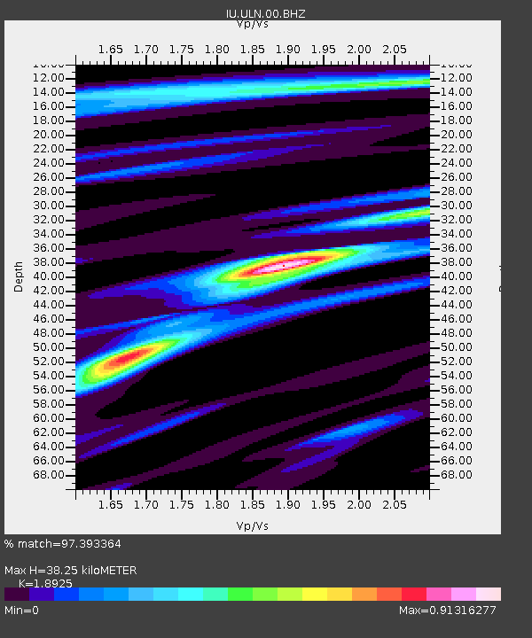
| Arrivals | |
| Ps | 5.4 SECOND |
| PpPs | 16 SECOND |
| PsPs/PpSs | 21 SECOND |

