J20K Nowitna River, AK, USA - Earthquake Result Viewer
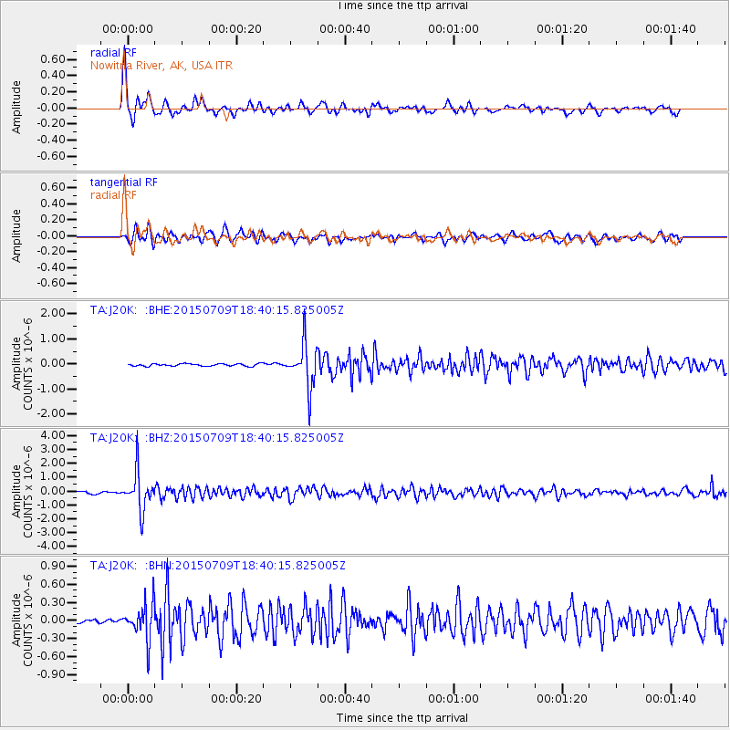
Earthquake location: Near East Coast Of Honshu, Japan
Earthquake latitude/longitude: 40.4/141.5
Earthquake time(UTC): 2015/07/09 (190) 18:32:51 GMT
Earthquake Depth: 79 km
Earthquake Magnitude: 5.6 MWB, 5.5 MWW, 5.6 MWR, 5.6 MWC
Earthquake Catalog/Contributor: NEIC PDE/NEIC COMCAT
Network: TA USArray Transportable Network (new EarthScope stations)
Station: J20K Nowitna River, AK, USA
Lat/Lon: 64.18 N/154.15 W
Elevation: 314 m
Distance: 43.6 deg
Az: 34.965 deg
Baz: 268.792 deg
Ray Param: 0.072210096
Estimated Moho Depth: 34.75 km
Estimated Crust Vp/Vs: 1.68
Assumed Crust Vp: 6.566 km/s
Estimated Crust Vs: 3.92 km/s
Estimated Crust Poisson's Ratio: 0.22
Radial Match: 90.85869 %
Radial Bump: 389
Transverse Match: 79.36746 %
Transverse Bump: 400
SOD ConfigId: 7422571
Insert Time: 2019-04-19 18:08:51.295 +0000
GWidth: 2.5
Max Bumps: 400
Tol: 0.001

Signal To Noise

ChannelStoNSTALTA
TA:J20K: :BHZ:20150709T18:40:15.825005Z18.5901221.4106794E-67.588328E-8
TA:J20K: :BHN:20150709T18:40:15.825005Z7.6083152.985596E-73.9241225E-8
TA:J20K: :BHE:20150709T18:40:15.825005Z18.7740468.90654E-74.7440704E-8
Arrivals
Ps3.8 SECOND
PpPs13 SECOND
PsPs/PpSs17 SECOND