You are here: Home > Network List > TA - USArray Transportable Network (new EarthScope stations) Stations List
> Station O48A Farmland, IN, USA > Earthquake Result Viewer
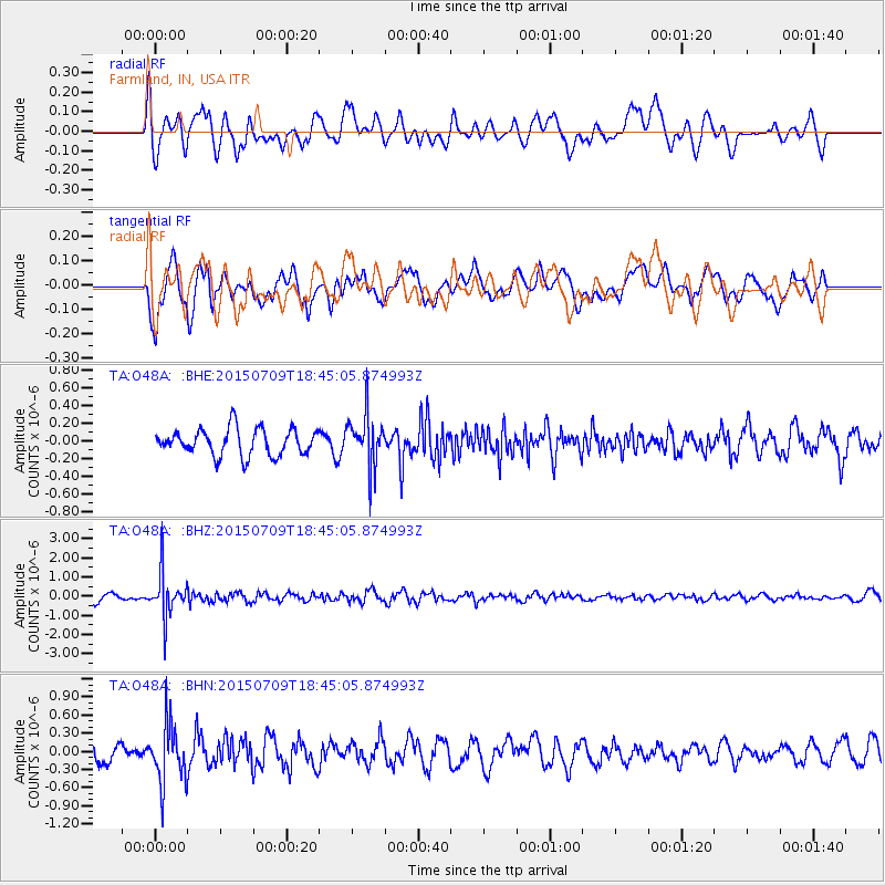
O48A Farmland, IN, USA - Earthquake Result Viewer
*The percent match for this event was below the threshold and hence no stack was calculated.
| Earthquake location: |
Near East Coast Of Honshu, Japan |
| Earthquake latitude/longitude: |
40.4/141.5 |
| Earthquake time(UTC): |
2015/07/09 (190) 18:32:51 GMT |
| Earthquake Depth: |
79 km |
| Earthquake Magnitude: |
5.6 MWB, 5.5 MWW, 5.6 MWR, 5.6 MWC |
| Earthquake Catalog/Contributor: |
NEIC PDE/NEIC COMCAT |
|
| Network: |
TA USArray Transportable Network (new EarthScope stations) |
| Station: |
O48A Farmland, IN, USA |
| Lat/Lon: |
40.26 N/85.16 W |
| Elevation: |
300 m |
|
| Distance: |
89.2 deg |
| Az: |
33.807 deg |
| Baz: |
326.253 deg |
| Ray Param: |
$rayparam |
*The percent match for this event was below the threshold and hence was not used in the summary stack. |
|
| Radial Match: |
58.460243 % |
| Radial Bump: |
400 |
| Transverse Match: |
73.294586 % |
| Transverse Bump: |
400 |
| SOD ConfigId: |
7422571 |
| Insert Time: |
2019-04-19 18:09:23.721 +0000 |
| GWidth: |
2.5 |
| Max Bumps: |
400 |
| Tol: |
0.001 |
|
Signal To Noise
| Channel | StoN | STA | LTA |
| TA:O48A: :BHZ:20150709T18:45:05.874993Z | 4.0116425 | 1.1230579E-6 | 2.7994963E-7 |
| TA:O48A: :BHN:20150709T18:45:05.874993Z | 3.095598 | 4.9594837E-7 | 1.6021083E-7 |
| TA:O48A: :BHE:20150709T18:45:05.874993Z | 1.9274498 | 2.89178E-7 | 1.500314E-7 |
| Arrivals |
| Ps | |
| PpPs | |
| PsPs/PpSs | |


