
LEBA Lebam, WA, USA - Earthquake Result Viewer
| ||||||||||||||||||
| ||||||||||||||||||
| ||||||||||||||||||
|
Signal To Noise
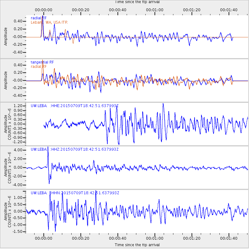
| Channel | StoN | STA | LTA |
| UW:LEBA: :HHZ:20150709T18:42:51.637993Z | 10.125999 | 1.7072484E-6 | 1.6860048E-7 |
| UW:LEBA: :HHN:20150709T18:42:51.637993Z | 5.671351 | 5.67632E-7 | 1.0008762E-7 |
| UW:LEBA: :HHE:20150709T18:42:51.637993Z | 2.9049168 | 4.4834832E-7 | 1.543412E-7 |
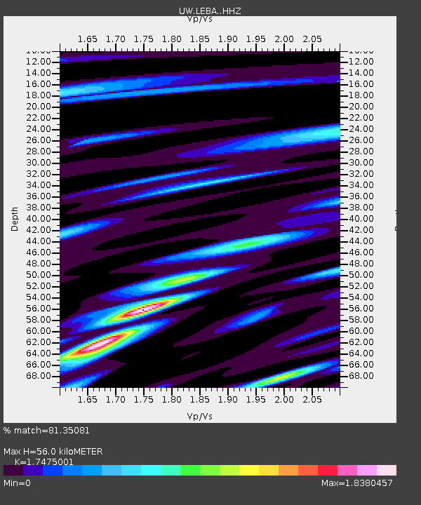
| Arrivals | |
| Ps | 6.7 SECOND |
| PpPs | 22 SECOND |
| PsPs/PpSs | 29 SECOND |

