You are here: Home > Network List > IU - Global Seismograph Network (GSN - IRIS/USGS) Stations List
> Station ULN Ulaanbaatar, Mongolia > Earthquake Result Viewer
ULN Ulaanbaatar, Mongolia - Earthquake Result Viewer

| Earthquake location: |
Solomon Islands |
| Earthquake latitude/longitude: |
-9.6/159.5 |
| Earthquake time(UTC): |
2001/12/23 (357) 22:52:54 GMT |
| Earthquake Depth: |
16 km |
| Earthquake Magnitude: |
6.2 MB, 7.0 MS, 6.8 MW, 6.7 MW |
| Earthquake Catalog/Contributor: |
WHDF/NEIC |
|
| Network: |
IU Global Seismograph Network (GSN - IRIS/USGS) |
| Station: |
ULN Ulaanbaatar, Mongolia |
| Lat/Lon: |
47.87 N/107.05 E |
| Elevation: |
1610 m |
|
| Distance: |
73.6 deg |
| Az: |
326.179 deg |
| Baz: |
125.398 deg |
| Ray Param: |
0.0528625 |
| Estimated Moho Depth: |
49.25 km |
| Estimated Crust Vp/Vs: |
1.70 |
| Assumed Crust Vp: |
6.642 km/s |
| Estimated Crust Vs: |
3.901 km/s |
| Estimated Crust Poisson's Ratio: |
0.24 |
|
| Radial Match: |
98.576004 % |
| Radial Bump: |
242 |
| Transverse Match: |
90.79931 % |
| Transverse Bump: |
400 |
| SOD ConfigId: |
20082 |
| Insert Time: |
2010-03-03 16:17:12.394 +0000 |
| GWidth: |
2.5 |
| Max Bumps: |
400 |
| Tol: |
0.001 |
|
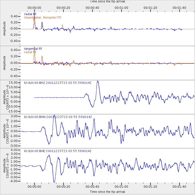
Signal To Noise
| Channel | StoN | STA | LTA |
| IU:ULN:00:BHN:20011223T23:03:55.569014Z | 1.2229358 | 7.995281E-8 | 6.537777E-8 |
| IU:ULN:00:BHE:20011223T23:03:55.569014Z | 2.1634257 | 1.4578835E-7 | 6.738773E-8 |
| IU:ULN:00:BHZ:20011223T23:03:55.569014Z | 5.028686 | 4.2308665E-7 | 8.413463E-8 |
| Arrivals |
| Ps | 5.4 SECOND |
| PpPs | 19 SECOND |
| PsPs/PpSs | 25 SECOND |


