
ULN Ulaanbaatar, Mongolia - Earthquake Result Viewer
| ||||||||||||||||||
| ||||||||||||||||||
| ||||||||||||||||||
|
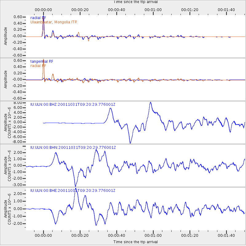
Signal To Noise
| Channel | StoN | STA | LTA |
| IU:ULN:00:BHN:20011031T09:20:29.776001Z | 3.010175 | 1.4776424E-7 | 4.9088257E-8 |
| IU:ULN:00:BHE:20011031T09:20:29.776001Z | 3.384588 | 1.3078457E-7 | 3.8641208E-8 |
| IU:ULN:00:BHZ:20011031T09:20:29.776001Z | 8.541401 | 5.301293E-7 | 6.2065844E-8 |
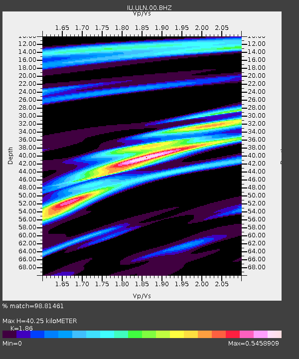
| Arrivals | |
| Ps | 5.4 SECOND |
| PpPs | 17 SECOND |
| PsPs/PpSs | 22 SECOND |

