You are here: Home > Network List > IU - Global Seismograph Network (GSN - IRIS/USGS) Stations List
> Station RSSD Black Hills, South Dakota, USA > Earthquake Result Viewer
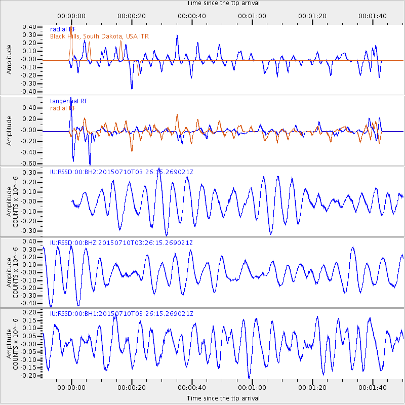
RSSD Black Hills, South Dakota, USA - Earthquake Result Viewer
*The percent match for this event was below the threshold and hence no stack was calculated.
| Earthquake location: |
Kuril Islands |
| Earthquake latitude/longitude: |
44.3/147.8 |
| Earthquake time(UTC): |
2015/07/10 (191) 03:15:37 GMT |
| Earthquake Depth: |
93 km |
| Earthquake Magnitude: |
4.3 mb |
| Earthquake Catalog/Contributor: |
ISC/ISC |
|
| Network: |
IU Global Seismograph Network (GSN - IRIS/USGS) |
| Station: |
RSSD Black Hills, South Dakota, USA |
| Lat/Lon: |
44.12 N/104.04 W |
| Elevation: |
2090 m |
|
| Distance: |
71.2 deg |
| Az: |
46.309 deg |
| Baz: |
313.894 deg |
| Ray Param: |
$rayparam |
*The percent match for this event was below the threshold and hence was not used in the summary stack. |
|
| Radial Match: |
56.24727 % |
| Radial Bump: |
400 |
| Transverse Match: |
82.8811 % |
| Transverse Bump: |
400 |
| SOD ConfigId: |
7422571 |
| Insert Time: |
2019-04-19 18:16:54.650 +0000 |
| GWidth: |
2.5 |
| Max Bumps: |
400 |
| Tol: |
0.001 |
|
Signal To Noise
| Channel | StoN | STA | LTA |
| IU:RSSD:00:BHZ:20150710T03:26:15.269021Z | 1.6937101 | 2.7841836E-7 | 1.643837E-7 |
| IU:RSSD:00:BH1:20150710T03:26:15.269021Z | 0.48555446 | 5.4818724E-8 | 1.1289923E-7 |
| IU:RSSD:00:BH2:20150710T03:26:15.269021Z | 1.882754 | 2.1498407E-7 | 1.14185966E-7 |
| Arrivals |
| Ps | |
| PpPs | |
| PsPs/PpSs | |


