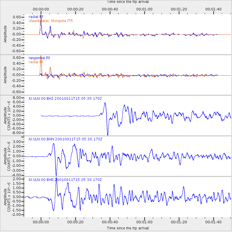
ULN Ulaanbaatar, Mongolia - Earthquake Result Viewer
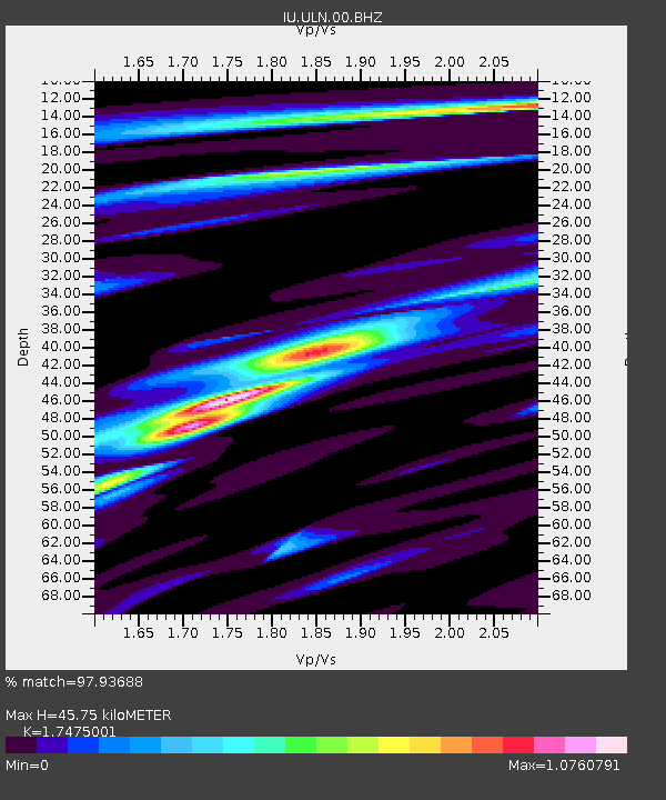
Earthquake location: Irian Jaya Region, Indonesia
Earthquake latitude/longitude: -0.6/133.1
Earthquake time(UTC): 2001/09/11 (254) 14:56:50 GMT
Earthquake Depth: 33 km
Earthquake Magnitude: 5.8 MB, 6.4 MS, 6.6 MW, 6.5 MW
Earthquake Catalog/Contributor: WHDF/NEIC
Network: IU Global Seismograph Network (GSN - IRIS/USGS)
Station: ULN Ulaanbaatar, Mongolia
Lat/Lon: 47.87 N/107.05 E
Elevation: 1610 m
Distance: 53.3 deg
Az: 338.341 deg
Baz: 146.764 deg
Ray Param: 0.066117555
Estimated Moho Depth: 45.75 km
Estimated Crust Vp/Vs: 1.75
Assumed Crust Vp: 6.642 km/s
Estimated Crust Vs: 3.801 km/s
Estimated Crust Poisson's Ratio: 0.26
Radial Match: 97.93688 %
Radial Bump: 298
Transverse Match: 88.82818 %
Transverse Bump: 400
SOD ConfigId: 20082
Insert Time: 2010-03-03 16:17:27.003 +0000
GWidth: 2.5
Max Bumps: 400
Tol: 0.001

Signal To Noise

ChannelStoNSTALTA
IU:ULN:00:BHN:20010911T15:05:36.170Z5.4055012.019442E-73.7359015E-8
IU:ULN:00:BHE:20010911T15:05:36.170Z1.89605071.1263002E-75.940243E-8
IU:ULN:00:BHZ:20010911T15:05:36.170Z7.43551873.6783996E-74.9470653E-8
Arrivals
Ps5.5 SECOND
PpPs18 SECOND
PsPs/PpSs23 SECOND