
ULN Ulaanbaatar, Mongolia - Earthquake Result Viewer
| ||||||||||||||||||
| ||||||||||||||||||
| ||||||||||||||||||
|
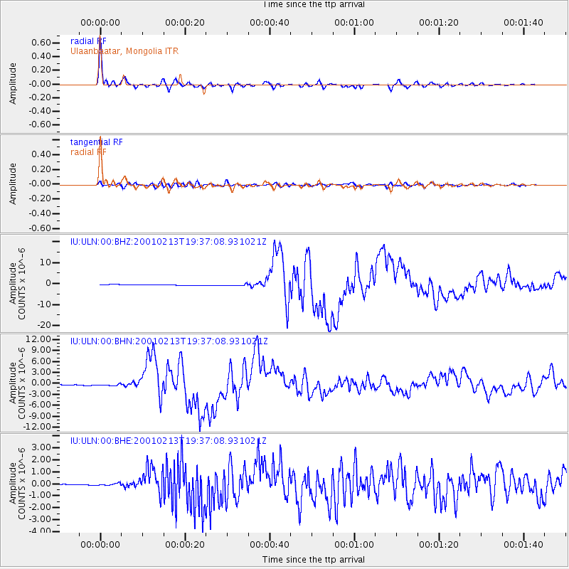
Signal To Noise
| Channel | StoN | STA | LTA |
| IU:ULN:00:BHN:20010213T19:37:08.931021Z | 2.4123588 | 2.688052E-7 | 1.11428356E-7 |
| IU:ULN:00:BHE:20010213T19:37:08.931021Z | 1.2286869 | 8.11017E-8 | 6.600681E-8 |
| IU:ULN:00:BHZ:20010213T19:37:08.931021Z | 2.5697057 | 4.4637056E-7 | 1.7370493E-7 |
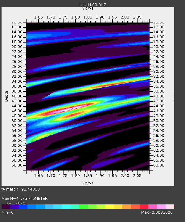
| Arrivals | |
| Ps | 5.6 SECOND |
| PpPs | 18 SECOND |
| PsPs/PpSs | 23 SECOND |

