You are here: Home > Network List > AV - Alaska Volcano Observatory Stations List
> Station MAPS Pakushin Southeast, Makushin Volcano, Alaska > Earthquake Result Viewer
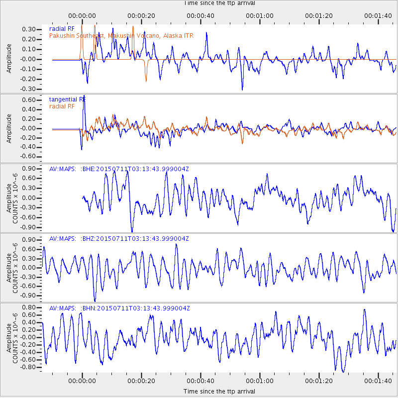
MAPS Pakushin Southeast, Makushin Volcano, Alaska - Earthquake Result Viewer
*The percent match for this event was below the threshold and hence no stack was calculated.
| Earthquake location: |
New Ireland Region, P.N.G. |
| Earthquake latitude/longitude: |
-5.0/153.6 |
| Earthquake time(UTC): |
2015/07/11 (192) 03:03:26 GMT |
| Earthquake Depth: |
56 km |
| Earthquake Magnitude: |
4.8 mb |
| Earthquake Catalog/Contributor: |
ISC/ISC |
|
| Network: |
AV Alaska Volcano Observatory |
| Station: |
MAPS Pakushin Southeast, Makushin Volcano, Alaska |
| Lat/Lon: |
53.81 N/166.94 W |
| Elevation: |
333 m |
|
| Distance: |
67.2 deg |
| Az: |
24.115 deg |
| Baz: |
223.341 deg |
| Ray Param: |
$rayparam |
*The percent match for this event was below the threshold and hence was not used in the summary stack. |
|
| Radial Match: |
51.6436 % |
| Radial Bump: |
400 |
| Transverse Match: |
63.93681 % |
| Transverse Bump: |
400 |
| SOD ConfigId: |
7422571 |
| Insert Time: |
2019-04-19 18:36:11.939 +0000 |
| GWidth: |
2.5 |
| Max Bumps: |
400 |
| Tol: |
0.001 |
|
Signal To Noise
| Channel | StoN | STA | LTA |
| AV:MAPS: :BHZ:20150711T03:13:43.999004Z | 1.8101417 | 4.5642696E-7 | 2.5214985E-7 |
| AV:MAPS: :BHN:20150711T03:13:43.999004Z | 1.257778 | 3.4489622E-7 | 2.7421072E-7 |
| AV:MAPS: :BHE:20150711T03:13:43.999004Z | 0.90837044 | 3.6731632E-7 | 4.0436842E-7 |
| Arrivals |
| Ps | |
| PpPs | |
| PsPs/PpSs | |


