You are here: Home > Network List > US - United States National Seismic Network Stations List
> Station DGMT Dagmar, Montana, USA > Earthquake Result Viewer
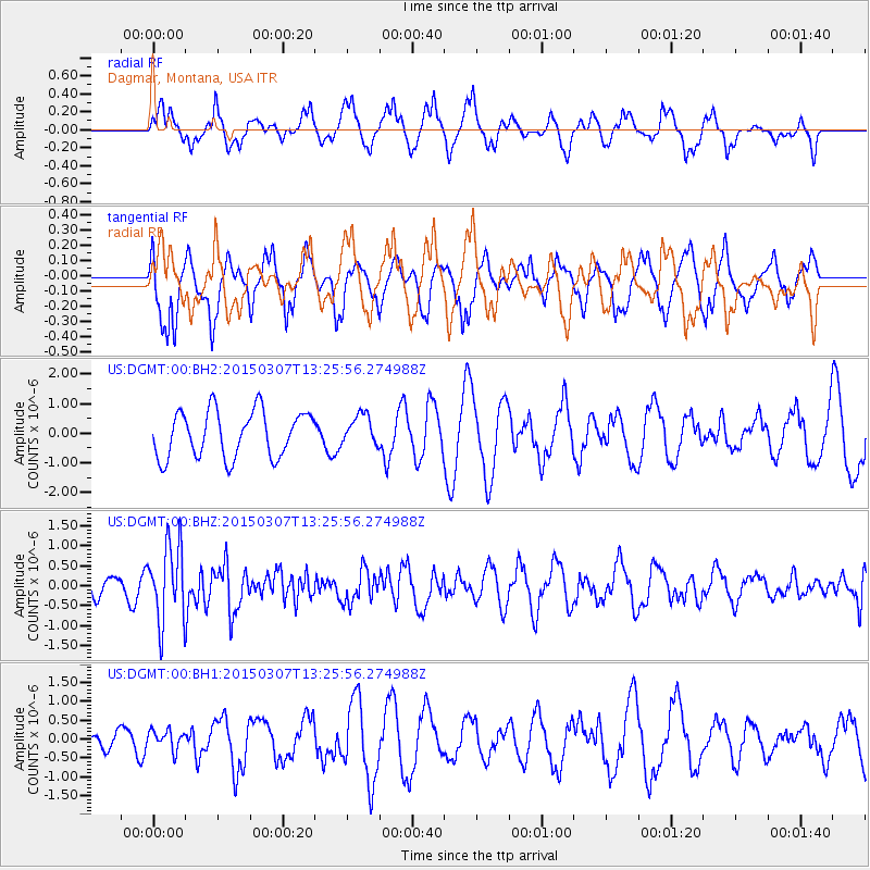
DGMT Dagmar, Montana, USA - Earthquake Result Viewer
*The percent match for this event was below the threshold and hence no stack was calculated.
| Earthquake location: |
Andreanof Islands, Aleutian Is. |
| Earthquake latitude/longitude: |
50.5/-173.3 |
| Earthquake time(UTC): |
2015/03/07 (066) 13:18:24 GMT |
| Earthquake Depth: |
10 km |
| Earthquake Magnitude: |
5.7 MO |
| Earthquake Catalog/Contributor: |
NEIC PDE/NEIC ALERT |
|
| Network: |
US United States National Seismic Network |
| Station: |
DGMT Dagmar, Montana, USA |
| Lat/Lon: |
48.47 N/104.20 W |
| Elevation: |
0.0 m |
|
| Distance: |
43.5 deg |
| Az: |
64.715 deg |
| Baz: |
299.89 deg |
| Ray Param: |
$rayparam |
*The percent match for this event was below the threshold and hence was not used in the summary stack. |
|
| Radial Match: |
47.95531 % |
| Radial Bump: |
372 |
| Transverse Match: |
44.064083 % |
| Transverse Bump: |
356 |
| SOD ConfigId: |
872571 |
| Insert Time: |
2015-03-21 13:46:07.391 +0000 |
| GWidth: |
2.5 |
| Max Bumps: |
400 |
| Tol: |
0.001 |
|
Signal To Noise
| Channel | StoN | STA | LTA |
| US:DGMT:00:BHZ:20150307T13:25:56.274988Z | 3.6731286 | 9.666675E-7 | 2.631728E-7 |
| US:DGMT:00:BH1:20150307T13:25:56.274988Z | 0.67543066 | 2.60728E-7 | 3.860174E-7 |
| US:DGMT:00:BH2:20150307T13:25:56.274988Z | 0.65780073 | 5.1285645E-7 | 7.796532E-7 |
| Arrivals |
| Ps | |
| PpPs | |
| PsPs/PpSs | |


