You are here: Home > Network List > TA - USArray Transportable Network (new EarthScope stations) Stations List
> Station G65A Princeton, ME, USA > Earthquake Result Viewer
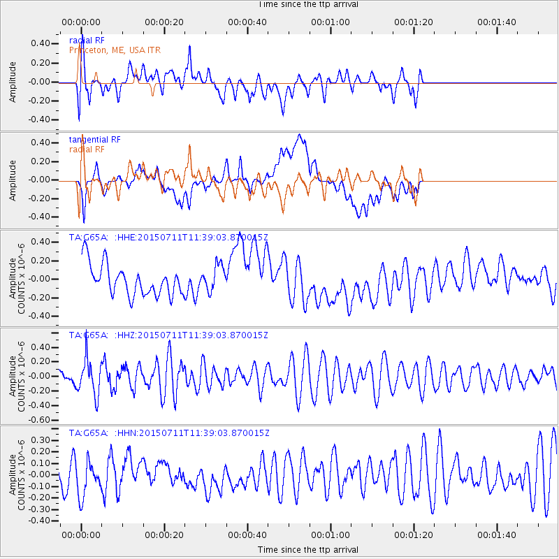
G65A Princeton, ME, USA - Earthquake Result Viewer
*The percent match for this event was below the threshold and hence no stack was calculated.
| Earthquake location: |
East Of Kuril Islands |
| Earthquake latitude/longitude: |
43.9/148.0 |
| Earthquake time(UTC): |
2015/07/11 (192) 11:26:59 GMT |
| Earthquake Depth: |
32 km |
| Earthquake Magnitude: |
5.5 MB |
| Earthquake Catalog/Contributor: |
NEIC PDE/NEIC COMCAT |
|
| Network: |
TA USArray Transportable Network (new EarthScope stations) |
| Station: |
G65A Princeton, ME, USA |
| Lat/Lon: |
45.20 N/67.56 W |
| Elevation: |
78 m |
|
| Distance: |
85.8 deg |
| Az: |
24.365 deg |
| Baz: |
335.051 deg |
| Ray Param: |
$rayparam |
*The percent match for this event was below the threshold and hence was not used in the summary stack. |
|
| Radial Match: |
61.608837 % |
| Radial Bump: |
400 |
| Transverse Match: |
41.51719 % |
| Transverse Bump: |
400 |
| SOD ConfigId: |
7422571 |
| Insert Time: |
2019-04-19 18:52:46.614 +0000 |
| GWidth: |
2.5 |
| Max Bumps: |
400 |
| Tol: |
0.001 |
|
Signal To Noise
| Channel | StoN | STA | LTA |
| TA:G65A: :HHZ:20150711T11:39:03.870015Z | 1.4455152 | 2.4960977E-7 | 1.7267875E-7 |
| TA:G65A: :HHN:20150711T11:39:03.870015Z | 1.2371308 | 1.8062768E-7 | 1.4600532E-7 |
| TA:G65A: :HHE:20150711T11:39:03.870015Z | 0.86625135 | 1.4430356E-7 | 1.6658392E-7 |
| Arrivals |
| Ps | |
| PpPs | |
| PsPs/PpSs | |


