You are here: Home > Network List > TA - USArray Transportable Network (new EarthScope stations) Stations List
> Station H24K Noodor Dome, AK, USA > Earthquake Result Viewer
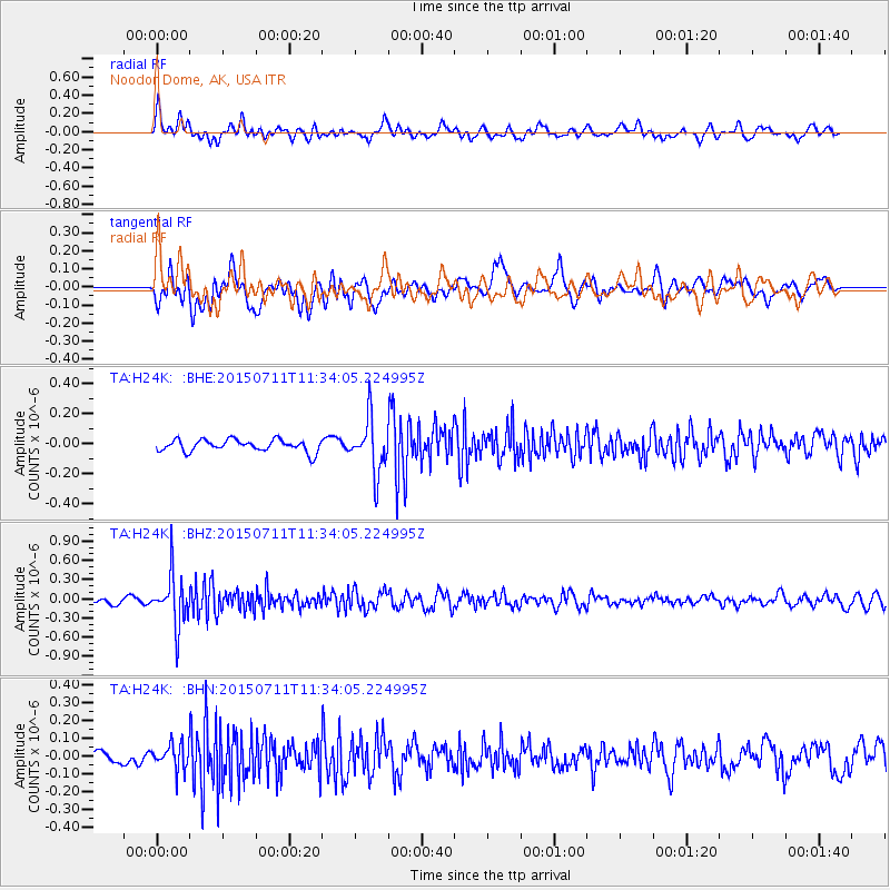
H24K Noodor Dome, AK, USA - Earthquake Result Viewer
*The percent match for this event was below the threshold and hence no stack was calculated.
| Earthquake location: |
East Of Kuril Islands |
| Earthquake latitude/longitude: |
43.9/148.0 |
| Earthquake time(UTC): |
2015/07/11 (192) 11:26:59 GMT |
| Earthquake Depth: |
32 km |
| Earthquake Magnitude: |
5.5 MB |
| Earthquake Catalog/Contributor: |
NEIC PDE/NEIC COMCAT |
|
| Network: |
TA USArray Transportable Network (new EarthScope stations) |
| Station: |
H24K Noodor Dome, AK, USA |
| Lat/Lon: |
65.84 N/147.88 W |
| Elevation: |
814 m |
|
| Distance: |
40.6 deg |
| Az: |
34.71 deg |
| Baz: |
269.704 deg |
| Ray Param: |
$rayparam |
*The percent match for this event was below the threshold and hence was not used in the summary stack. |
|
| Radial Match: |
62.705982 % |
| Radial Bump: |
400 |
| Transverse Match: |
60.873264 % |
| Transverse Bump: |
400 |
| SOD ConfigId: |
7422571 |
| Insert Time: |
2019-04-19 18:52:47.318 +0000 |
| GWidth: |
2.5 |
| Max Bumps: |
400 |
| Tol: |
0.001 |
|
Signal To Noise
| Channel | StoN | STA | LTA |
| TA:H24K: :BHZ:20150711T11:34:05.224995Z | 7.188419 | 3.9359256E-7 | 5.4753702E-8 |
| TA:H24K: :BHN:20150711T11:34:05.224995Z | 1.5597147 | 7.166317E-8 | 4.5946333E-8 |
| TA:H24K: :BHE:20150711T11:34:05.224995Z | 4.4916873 | 1.7809457E-7 | 3.9649816E-8 |
| Arrivals |
| Ps | |
| PpPs | |
| PsPs/PpSs | |


