You are here: Home > Network List > US - United States National Seismic Network Stations List
> Station WMOK Wichita Mountains, Oklahoma, USA > Earthquake Result Viewer
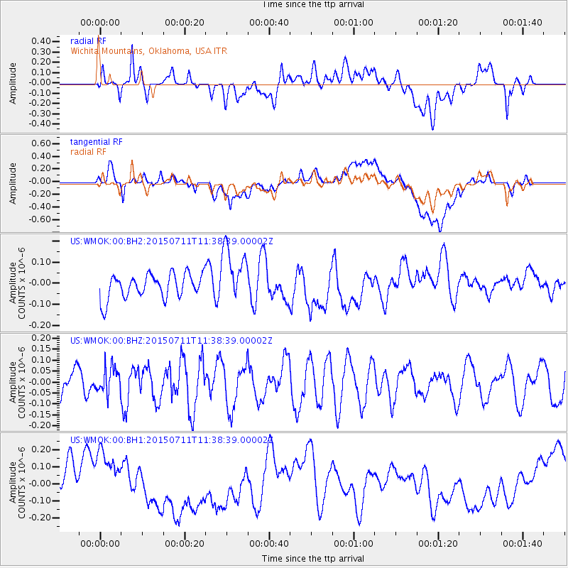
WMOK Wichita Mountains, Oklahoma, USA - Earthquake Result Viewer
*The percent match for this event was below the threshold and hence no stack was calculated.
| Earthquake location: |
East Of Kuril Islands |
| Earthquake latitude/longitude: |
43.9/148.0 |
| Earthquake time(UTC): |
2015/07/11 (192) 11:26:59 GMT |
| Earthquake Depth: |
32 km |
| Earthquake Magnitude: |
5.5 MB |
| Earthquake Catalog/Contributor: |
NEIC PDE/NEIC COMCAT |
|
| Network: |
US United States National Seismic Network |
| Station: |
WMOK Wichita Mountains, Oklahoma, USA |
| Lat/Lon: |
34.74 N/98.78 W |
| Elevation: |
486 m |
|
| Distance: |
80.9 deg |
| Az: |
50.046 deg |
| Baz: |
317.713 deg |
| Ray Param: |
$rayparam |
*The percent match for this event was below the threshold and hence was not used in the summary stack. |
|
| Radial Match: |
44.422733 % |
| Radial Bump: |
400 |
| Transverse Match: |
39.07537 % |
| Transverse Bump: |
400 |
| SOD ConfigId: |
7422571 |
| Insert Time: |
2019-04-19 18:53:37.004 +0000 |
| GWidth: |
2.5 |
| Max Bumps: |
400 |
| Tol: |
0.001 |
|
Signal To Noise
| Channel | StoN | STA | LTA |
| US:WMOK:00:BHZ:20150711T11:38:39.00002Z | 0.7484233 | 5.8993905E-8 | 7.882426E-8 |
| US:WMOK:00:BH1:20150711T11:38:39.00002Z | 1.630057 | 1.6009632E-7 | 9.821517E-8 |
| US:WMOK:00:BH2:20150711T11:38:39.00002Z | 2.2473633 | 1.2942677E-7 | 5.759049E-8 |
| Arrivals |
| Ps | |
| PpPs | |
| PsPs/PpSs | |


