FURI Mt. Furi, Ethiopia - Earthquake Result Viewer
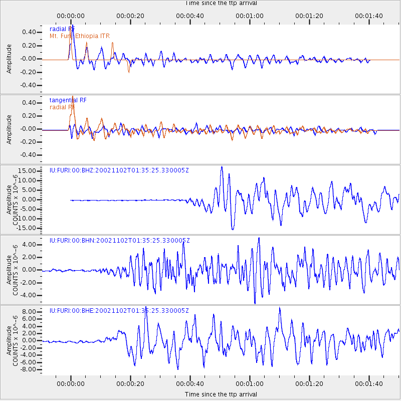
Earthquake location: Northern Sumatra, Indonesia
Earthquake latitude/longitude: 2.8/96.1
Earthquake time(UTC): 2002/11/02 (306) 01:26:10 GMT
Earthquake Depth: 30 km
Earthquake Magnitude: 6.2 MB, 7.6 MS, 7.4 MW, 7.4 MW
Earthquake Catalog/Contributor: WHDF/NEIC
Network: IU Global Seismograph Network (GSN - IRIS/USGS)
Station: FURI Mt. Furi, Ethiopia
Lat/Lon: 8.90 N/38.68 E
Elevation: 2570 m
Distance: 57.4 deg
Az: 278.699 deg
Baz: 92.334 deg
Ray Param: 0.063483685
Estimated Moho Depth: 33.25 km
Estimated Crust Vp/Vs: 2.02
Assumed Crust Vp: 6.464 km/s
Estimated Crust Vs: 3.2 km/s
Estimated Crust Poisson's Ratio: 0.34
Radial Match: 93.07877 %
Radial Bump: 400
Transverse Match: 87.17008 %
Transverse Bump: 400
SOD ConfigId: 4714
Insert Time: 2010-03-03 16:23:31.451 +0000
GWidth: 2.5
Max Bumps: 400
Tol: 0.001

Signal To Noise

ChannelStoNSTALTA
IU:FURI:00:BHN:20021102T01:35:25.330005Z0.94978348.178028E-88.610414E-8
IU:FURI:00:BHE:20021102T01:35:25.330005Z1.81078581.9477372E-71.0756309E-7
IU:FURI:00:BHZ:20021102T01:35:25.330005Z1.99277661.8075231E-79.070374E-8
Arrivals
Ps5.5 SECOND
PpPs15 SECOND
PsPs/PpSs20 SECOND