FURI Mt. Furi, Ethiopia - Earthquake Result Viewer
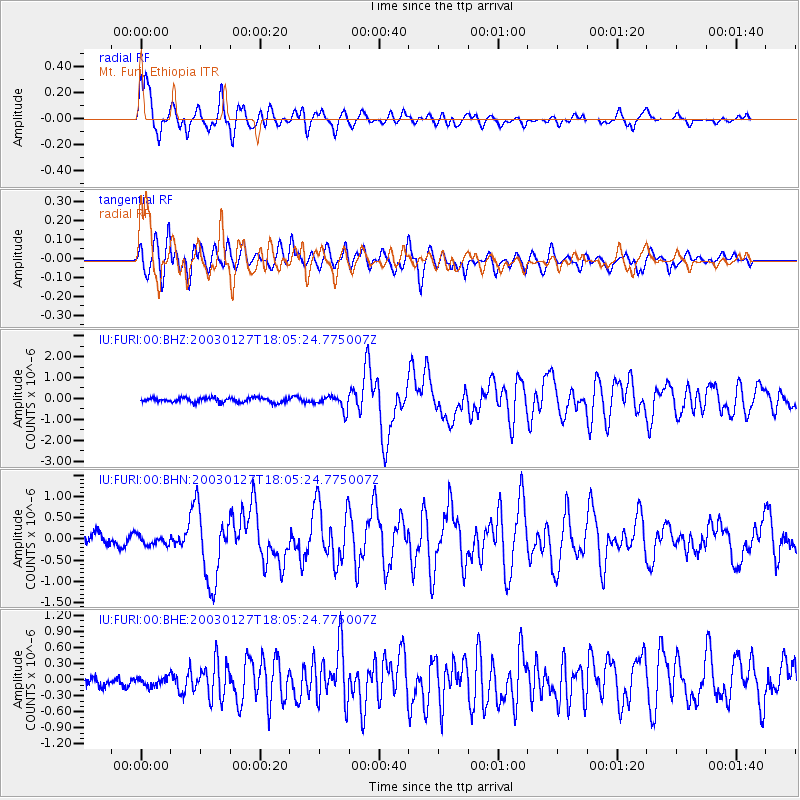
Earthquake location: Prince Edward Islands Region
Earthquake latitude/longitude: -46.0/35.1
Earthquake time(UTC): 2003/01/27 (027) 17:56:25 GMT
Earthquake Depth: 10 km
Earthquake Magnitude: 5.6 MB, 6.3 MS, 6.5 MW, 6.4 MW
Earthquake Catalog/Contributor: WHDF/NEIC
Network: IU Global Seismograph Network (GSN - IRIS/USGS)
Station: FURI Mt. Furi, Ethiopia
Lat/Lon: 8.90 N/38.68 E
Elevation: 2570 m
Distance: 54.8 deg
Az: 4.383 deg
Baz: 183.088 deg
Ray Param: 0.06522524
Estimated Moho Depth: 29.5 km
Estimated Crust Vp/Vs: 2.10
Assumed Crust Vp: 6.464 km/s
Estimated Crust Vs: 3.082 km/s
Estimated Crust Poisson's Ratio: 0.35
Radial Match: 88.863045 %
Radial Bump: 400
Transverse Match: 85.31674 %
Transverse Bump: 400
SOD ConfigId: 4714
Insert Time: 2010-03-03 16:23:33.273 +0000
GWidth: 2.5
Max Bumps: 400
Tol: 0.001

Signal To Noise

ChannelStoNSTALTA
IU:FURI:00:BHN:20030127T18:05:24.775007Z0.891014931.12202734E-71.2592689E-7
IU:FURI:00:BHE:20030127T18:05:24.775007Z0.953319551.09775215E-71.1515049E-7
IU:FURI:00:BHZ:20030127T18:05:24.775007Z3.10594463.393621E-71.0926212E-7
Arrivals
Ps5.2 SECOND
PpPs14 SECOND
PsPs/PpSs19 SECOND