You are here: Home > Network List > CN - Canadian National Seismograph Network Stations List
> Station INK INUVIK, NT > Earthquake Result Viewer
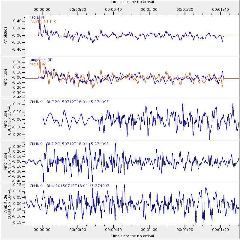
INK INUVIK, NT - Earthquake Result Viewer
*The percent match for this event was below the threshold and hence no stack was calculated.
| Earthquake location: |
Kyushu, Japan |
| Earthquake latitude/longitude: |
33.0/131.8 |
| Earthquake time(UTC): |
2015/07/12 (193) 17:52:05 GMT |
| Earthquake Depth: |
47 km |
| Earthquake Magnitude: |
5.5 MB, 5.5 MWC |
| Earthquake Catalog/Contributor: |
NEIC PDE/NEIC COMCAT |
|
| Network: |
CN Canadian National Seismograph Network |
| Station: |
INK INUVIK, NT |
| Lat/Lon: |
68.31 N/133.53 W |
| Elevation: |
44 m |
|
| Distance: |
61.4 deg |
| Az: |
24.95 deg |
| Baz: |
287.62 deg |
| Ray Param: |
$rayparam |
*The percent match for this event was below the threshold and hence was not used in the summary stack. |
|
| Radial Match: |
46.66948 % |
| Radial Bump: |
400 |
| Transverse Match: |
55.705116 % |
| Transverse Bump: |
400 |
| SOD ConfigId: |
7422571 |
| Insert Time: |
2019-04-19 19:04:29.138 +0000 |
| GWidth: |
2.5 |
| Max Bumps: |
400 |
| Tol: |
0.001 |
|
Signal To Noise
| Channel | StoN | STA | LTA |
| CN:INK: :BHZ:20150712T18:01:45.27499Z | 3.5969317 | 1.5966422E-7 | 4.4389004E-8 |
| CN:INK: :BHN:20150712T18:01:45.27499Z | 1.1731287 | 5.1611714E-8 | 4.3994927E-8 |
| CN:INK: :BHE:20150712T18:01:45.27499Z | 1.2270801 | 6.860675E-8 | 5.5910572E-8 |
| Arrivals |
| Ps | |
| PpPs | |
| PsPs/PpSs | |


