FURI Mt. Furi, Ethiopia - Earthquake Result Viewer
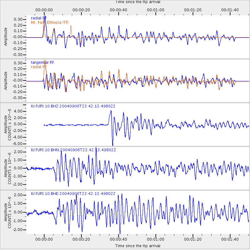
Earthquake location: Near S. Coast Of Honshu, Japan
Earthquake latitude/longitude: 33.2/137.2
Earthquake time(UTC): 2004/09/06 (250) 23:29:35 GMT
Earthquake Depth: 10 km
Earthquake Magnitude: 6.4 MB, 6.3 MS, 6.7 MW, 6.5 MW
Earthquake Catalog/Contributor: WHDF/NEIC
Network: IU Global Seismograph Network (GSN - IRIS/USGS)
Station: FURI Mt. Furi, Ethiopia
Lat/Lon: 8.90 N/38.68 E
Elevation: 2570 m
Distance: 92.3 deg
Az: 282.064 deg
Baz: 56.071 deg
Ray Param: 0.041485477
Estimated Moho Depth: 14.0 km
Estimated Crust Vp/Vs: 1.60
Assumed Crust Vp: 6.464 km/s
Estimated Crust Vs: 4.04 km/s
Estimated Crust Poisson's Ratio: 0.18
Radial Match: 88.84785 %
Radial Bump: 400
Transverse Match: 89.2325 %
Transverse Bump: 400
SOD ConfigId: 2459
Insert Time: 2010-03-03 16:23:43.639 +0000
GWidth: 2.5
Max Bumps: 400
Tol: 0.001

Signal To Noise

ChannelStoNSTALTA
IU:FURI:10:BHN:20040906T23:42:13.49802Z0.65930796.8589976E-81.04033305E-7
IU:FURI:10:BHE:20040906T23:42:13.49802Z0.579794178.2993765E-81.431435E-7
IU:FURI:10:BHZ:20040906T23:42:13.49802Z2.81156232.8289378E-71.00617996E-7
Arrivals
Ps1.3 SECOND
PpPs5.5 SECOND
PsPs/PpSs6.8 SECOND