FURI Mt. Furi, Ethiopia - Earthquake Result Viewer
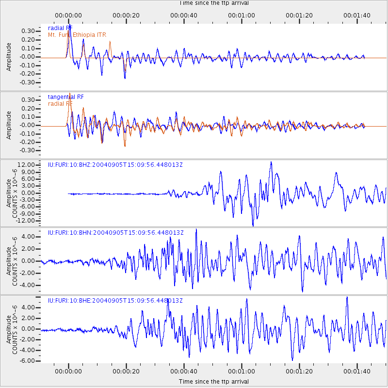
Earthquake location: Near S. Coast Of Honshu, Japan
Earthquake latitude/longitude: 33.2/137.1
Earthquake time(UTC): 2004/09/05 (249) 14:57:18 GMT
Earthquake Depth: 10 km
Earthquake Magnitude: 6.2 MB, 7.1 MS, 7.4 MW, 7.4 MW
Earthquake Catalog/Contributor: WHDF/NEIC
Network: IU Global Seismograph Network (GSN - IRIS/USGS)
Station: FURI Mt. Furi, Ethiopia
Lat/Lon: 8.90 N/38.68 E
Elevation: 2570 m
Distance: 92.1 deg
Az: 281.977 deg
Baz: 56.119 deg
Ray Param: 0.04150421
Estimated Moho Depth: 14.0 km
Estimated Crust Vp/Vs: 1.61
Assumed Crust Vp: 6.464 km/s
Estimated Crust Vs: 4.027 km/s
Estimated Crust Poisson's Ratio: 0.18
Radial Match: 93.62391 %
Radial Bump: 400
Transverse Match: 91.7932 %
Transverse Bump: 400
SOD ConfigId: 2459
Insert Time: 2010-03-03 16:23:45.667 +0000
GWidth: 2.5
Max Bumps: 400
Tol: 0.001

Signal To Noise

ChannelStoNSTALTA
IU:FURI:10:BHN:20040905T15:09:56.448013Z0.951703671.4673913E-71.5418574E-7
IU:FURI:10:BHE:20040905T15:09:56.448013Z1.38475291.399424E-71.0105948E-7
IU:FURI:10:BHZ:20040905T15:09:56.448013Z3.64460473.354516E-79.20406E-8
Arrivals
Ps1.3 SECOND
PpPs5.5 SECOND
PsPs/PpSs6.9 SECOND