
FURI Mt. Furi, Ethiopia - Earthquake Result Viewer
| ||||||||||||||||||
| ||||||||||||||||||
| ||||||||||||||||||
|
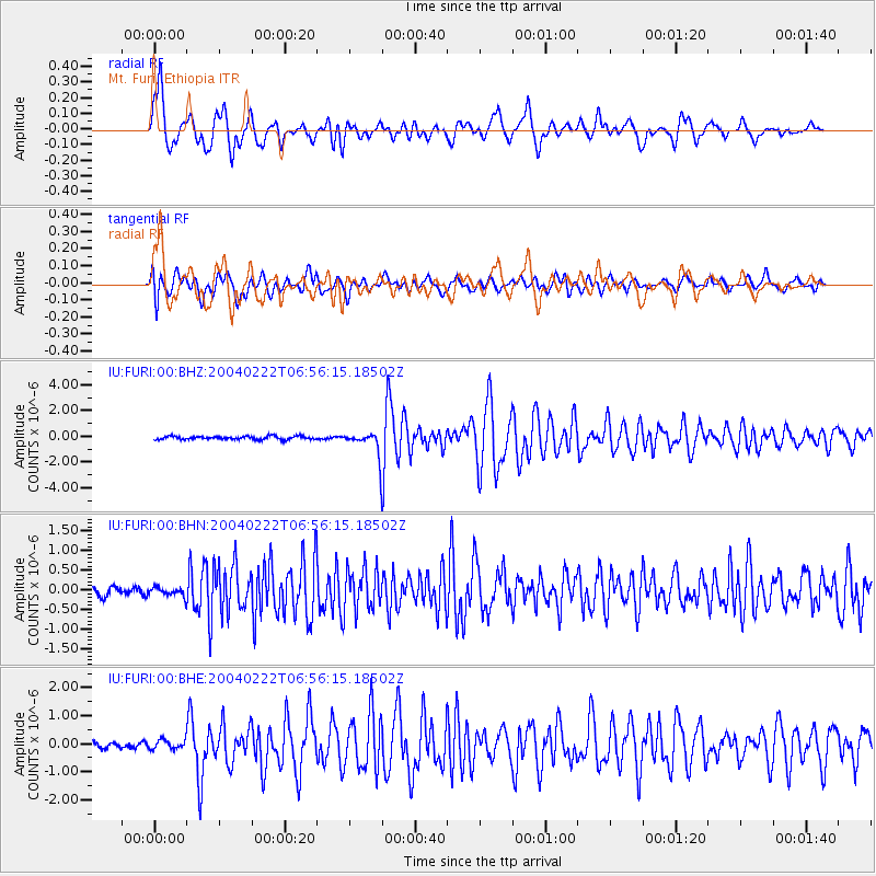
Signal To Noise
| Channel | StoN | STA | LTA |
| IU:FURI:00:BHN:20040222T06:56:15.18502Z | 1.1074923 | 1.1488051E-7 | 1.03730294E-7 |
| IU:FURI:00:BHE:20040222T06:56:15.18502Z | 1.2144067 | 1.676296E-7 | 1.3803414E-7 |
| IU:FURI:00:BHZ:20040222T06:56:15.18502Z | 7.885044 | 1.0397764E-6 | 1.3186691E-7 |
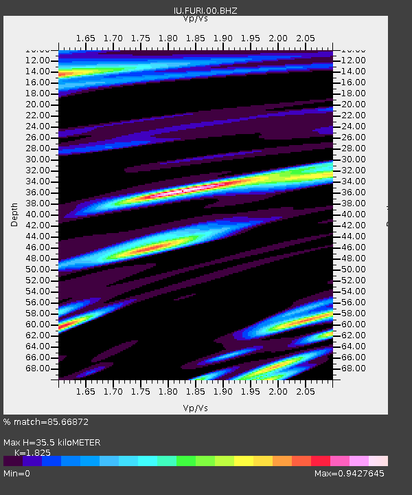
| Arrivals | |
| Ps | 4.7 SECOND |
| PpPs | 15 SECOND |
| PsPs/PpSs | 20 SECOND |

