You are here: Home > Network List > TA - USArray Transportable Network (new EarthScope stations) Stations List
> Station I23K Minto, Yukon-Koyukuk, AK, USA > Earthquake Result Viewer
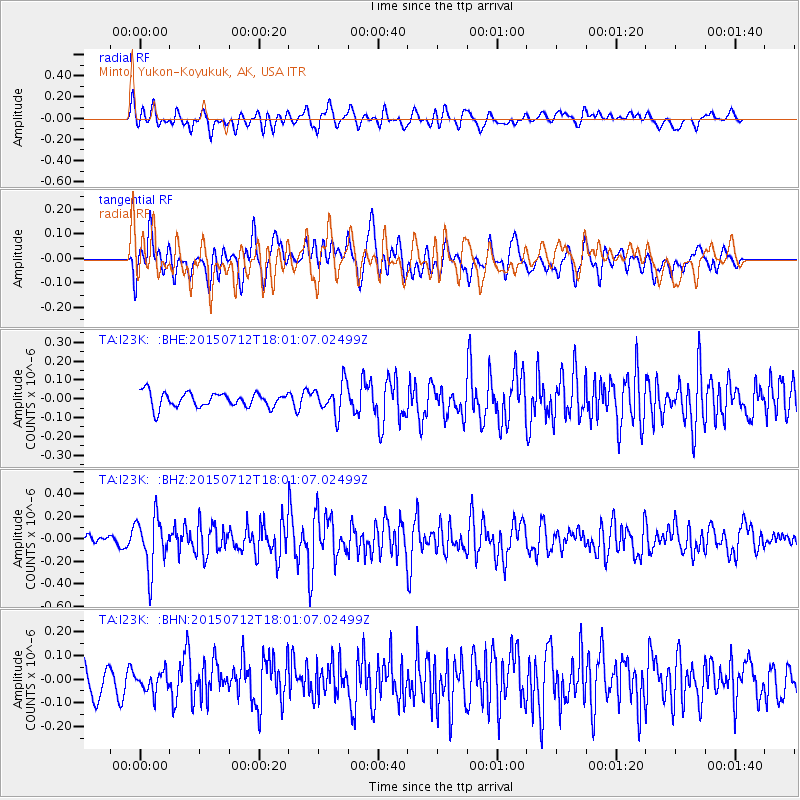
I23K Minto, Yukon-Koyukuk, AK, USA - Earthquake Result Viewer
*The percent match for this event was below the threshold and hence no stack was calculated.
| Earthquake location: |
Kyushu, Japan |
| Earthquake latitude/longitude: |
33.0/131.8 |
| Earthquake time(UTC): |
2015/07/12 (193) 17:52:05 GMT |
| Earthquake Depth: |
47 km |
| Earthquake Magnitude: |
5.5 MB, 5.5 MWC |
| Earthquake Catalog/Contributor: |
NEIC PDE/NEIC COMCAT |
|
| Network: |
TA USArray Transportable Network (new EarthScope stations) |
| Station: |
I23K Minto, Yukon-Koyukuk, AK, USA |
| Lat/Lon: |
65.15 N/149.36 W |
| Elevation: |
149 m |
|
| Distance: |
55.9 deg |
| Az: |
30.039 deg |
| Baz: |
275.717 deg |
| Ray Param: |
$rayparam |
*The percent match for this event was below the threshold and hence was not used in the summary stack. |
|
| Radial Match: |
61.642273 % |
| Radial Bump: |
400 |
| Transverse Match: |
62.5516 % |
| Transverse Bump: |
400 |
| SOD ConfigId: |
7422571 |
| Insert Time: |
2019-04-19 19:07:42.758 +0000 |
| GWidth: |
2.5 |
| Max Bumps: |
400 |
| Tol: |
0.001 |
|
Signal To Noise
| Channel | StoN | STA | LTA |
| TA:I23K: :BHZ:20150712T18:01:07.02499Z | 4.302786 | 2.2719647E-7 | 5.2802182E-8 |
| TA:I23K: :BHN:20150712T18:01:07.02499Z | 0.79131854 | 4.2128455E-8 | 5.3238303E-8 |
| TA:I23K: :BHE:20150712T18:01:07.02499Z | 2.2331407 | 8.1990656E-8 | 3.67154E-8 |
| Arrivals |
| Ps | |
| PpPs | |
| PsPs/PpSs | |


