You are here: Home > Network List > UW - Pacific Northwest Regional Seismic Network Stations List
> Station MRBL Marblemount, WA, USA > Earthquake Result Viewer
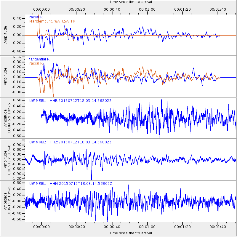
MRBL Marblemount, WA, USA - Earthquake Result Viewer
*The percent match for this event was below the threshold and hence no stack was calculated.
| Earthquake location: |
Kyushu, Japan |
| Earthquake latitude/longitude: |
33.0/131.8 |
| Earthquake time(UTC): |
2015/07/12 (193) 17:52:05 GMT |
| Earthquake Depth: |
47 km |
| Earthquake Magnitude: |
5.5 MB, 5.5 MWC |
| Earthquake Catalog/Contributor: |
NEIC PDE/NEIC COMCAT |
|
| Network: |
UW Pacific Northwest Regional Seismic Network |
| Station: |
MRBL Marblemount, WA, USA |
| Lat/Lon: |
48.52 N/121.48 W |
| Elevation: |
75 m |
|
| Distance: |
75.9 deg |
| Az: |
41.034 deg |
| Baz: |
303.958 deg |
| Ray Param: |
$rayparam |
*The percent match for this event was below the threshold and hence was not used in the summary stack. |
|
| Radial Match: |
70.544205 % |
| Radial Bump: |
400 |
| Transverse Match: |
70.02111 % |
| Transverse Bump: |
400 |
| SOD ConfigId: |
7422571 |
| Insert Time: |
2019-04-19 19:08:43.692 +0000 |
| GWidth: |
2.5 |
| Max Bumps: |
400 |
| Tol: |
0.001 |
|
Signal To Noise
| Channel | StoN | STA | LTA |
| UW:MRBL: :HHZ:20150712T18:03:14.56802Z | 2.2841058 | 2.1372516E-7 | 9.3570605E-8 |
| UW:MRBL: :HHN:20150712T18:03:14.56802Z | 1.3430551 | 1.3693244E-7 | 1.0195593E-7 |
| UW:MRBL: :HHE:20150712T18:03:14.56802Z | 1.5028774 | 1.3426323E-7 | 8.9337455E-8 |
| Arrivals |
| Ps | |
| PpPs | |
| PsPs/PpSs | |


