FURI Mt. Furi, Ethiopia - Earthquake Result Viewer
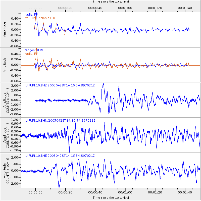
Earthquake location: Northern Sumatra, Indonesia
Earthquake latitude/longitude: 2.1/96.8
Earthquake time(UTC): 2005/04/28 (118) 14:07:33 GMT
Earthquake Depth: 22 km
Earthquake Magnitude: 5.9 MB, 6.2 MS, 6.3 MW, 6.2 MW
Earthquake Catalog/Contributor: WHDF/NEIC
Network: IU Global Seismograph Network (GSN - IRIS/USGS)
Station: FURI Mt. Furi, Ethiopia
Lat/Lon: 8.90 N/38.68 E
Elevation: 2570 m
Distance: 58.2 deg
Az: 279.089 deg
Baz: 93.006 deg
Ray Param: 0.06298213
Estimated Moho Depth: 69.0 km
Estimated Crust Vp/Vs: 1.95
Assumed Crust Vp: 6.464 km/s
Estimated Crust Vs: 3.319 km/s
Estimated Crust Poisson's Ratio: 0.32
Radial Match: 93.24229 %
Radial Bump: 400
Transverse Match: 86.78778 %
Transverse Bump: 400
SOD ConfigId: 2459
Insert Time: 2010-03-03 16:24:25.876 +0000
GWidth: 2.5
Max Bumps: 400
Tol: 0.001

Signal To Noise

ChannelStoNSTALTA
IU:FURI:10:BHN:20050428T14:16:54.897021Z1.15613069.905687E-88.567965E-8
IU:FURI:10:BHE:20050428T14:16:54.897021Z0.845768638.5798E-81.0144382E-7
IU:FURI:10:BHZ:20050428T14:16:54.897021Z1.05036641.10041064E-71.0476445E-7
Arrivals
Ps11 SECOND
PpPs30 SECOND
PsPs/PpSs41 SECOND