FURI Mt. Furi, Ethiopia - Earthquake Result Viewer
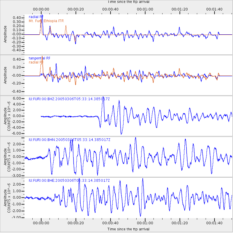
Earthquake location: North Of Severnaya Zemlya
Earthquake latitude/longitude: 84.9/99.4
Earthquake time(UTC): 2005/03/06 (065) 05:21:43 GMT
Earthquake Depth: 10 km
Earthquake Magnitude: 6.1 MB, 6.1 MS, 6.2 MW, 6.2 MW
Earthquake Catalog/Contributor: WHDF/NEIC
Network: IU Global Seismograph Network (GSN - IRIS/USGS)
Station: FURI Mt. Furi, Ethiopia
Lat/Lon: 8.90 N/38.68 E
Elevation: 2570 m
Distance: 78.7 deg
Az: 241.502 deg
Baz: 4.522 deg
Ray Param: 0.04946037
Estimated Moho Depth: 45.25 km
Estimated Crust Vp/Vs: 1.74
Assumed Crust Vp: 6.464 km/s
Estimated Crust Vs: 3.725 km/s
Estimated Crust Poisson's Ratio: 0.25
Radial Match: 91.14406 %
Radial Bump: 400
Transverse Match: 88.196884 %
Transverse Bump: 400
SOD ConfigId: 2455
Insert Time: 2010-03-03 16:24:36.863 +0000
GWidth: 2.5
Max Bumps: 400
Tol: 0.001

Signal To Noise

ChannelStoNSTALTA
IU:FURI:00:BHN:20050306T05:33:14.385017Z2.38331654.3657232E-71.831785E-7
IU:FURI:00:BHE:20050306T05:33:14.385017Z1.02168771.1491789E-71.1247848E-7
IU:FURI:00:BHZ:20050306T05:33:14.385017Z11.35479451.2733142E-61.12138906E-7
Arrivals
Ps5.3 SECOND
PpPs19 SECOND
PsPs/PpSs24 SECOND