
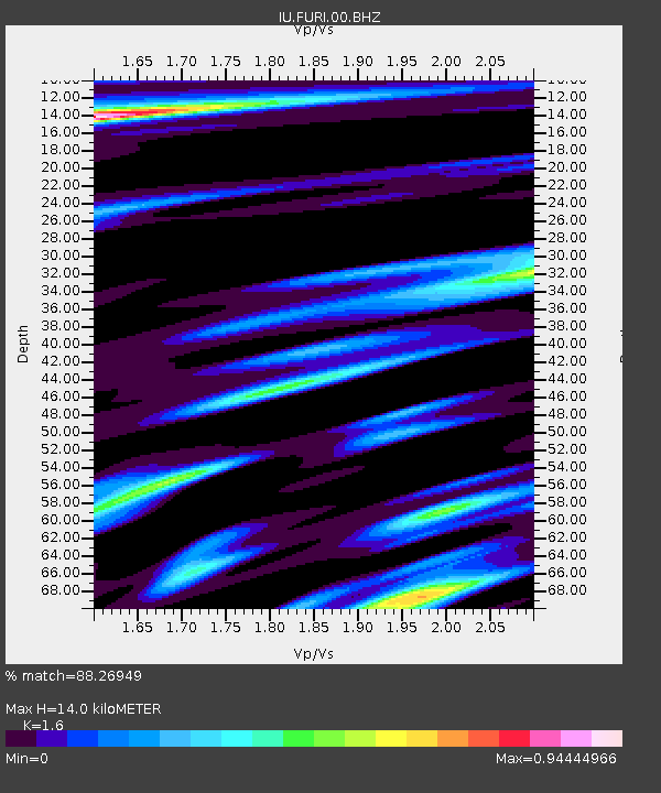
FURI Mt. Furi, Ethiopia - Earthquake Result Viewer
| ||||||||||||||||||
| ||||||||||||||||||
| ||||||||||||||||||
|
Signal To Noise
| Channel | StoN | STA | LTA |
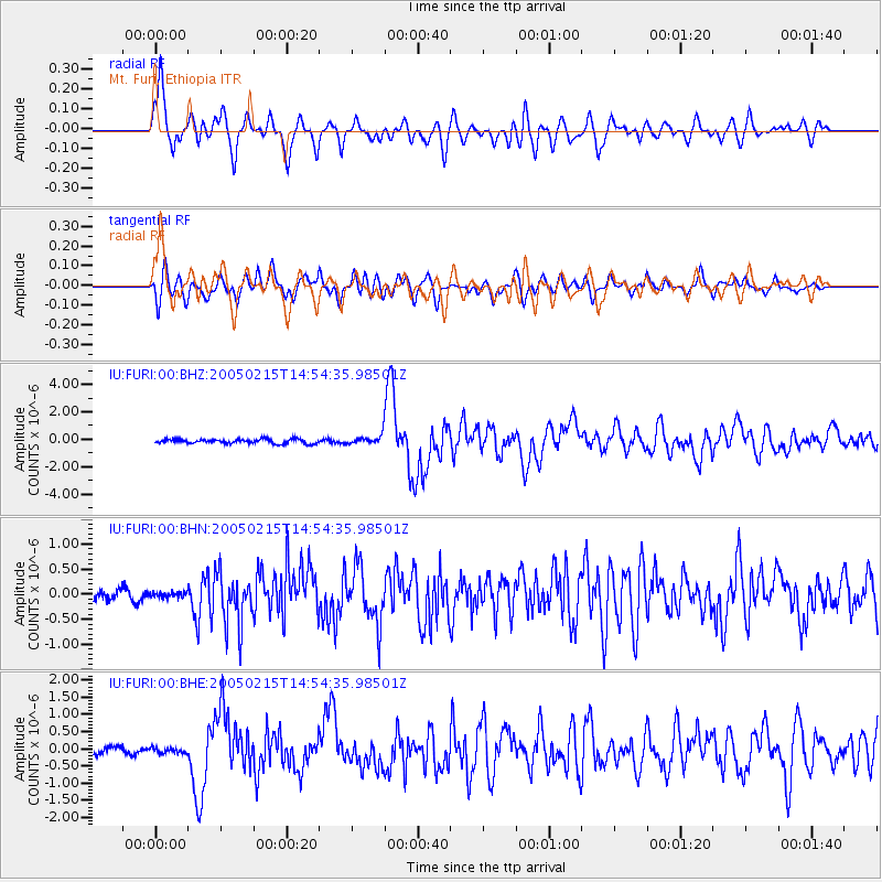
| IU:FURI:00:BHN:20050215T14:54:35.98501Z | 0.45083734 | 7.896861E-8 | 1.7515987E-7 |
| IU:FURI:00:BHE:20050215T14:54:35.98501Z | 0.7048078 | 7.4948765E-8 | 1.0633929E-7 |
| IU:FURI:00:BHZ:20050215T14:54:35.98501Z | 2.4114 | 3.8241265E-7 | 1.5858532E-7 |
| Arrivals | |
| Ps | 1.3 SECOND |
| PpPs | 5.5 SECOND |
| PsPs/PpSs | 6.8 SECOND |

