FURI Mt. Furi, Ethiopia - Earthquake Result Viewer
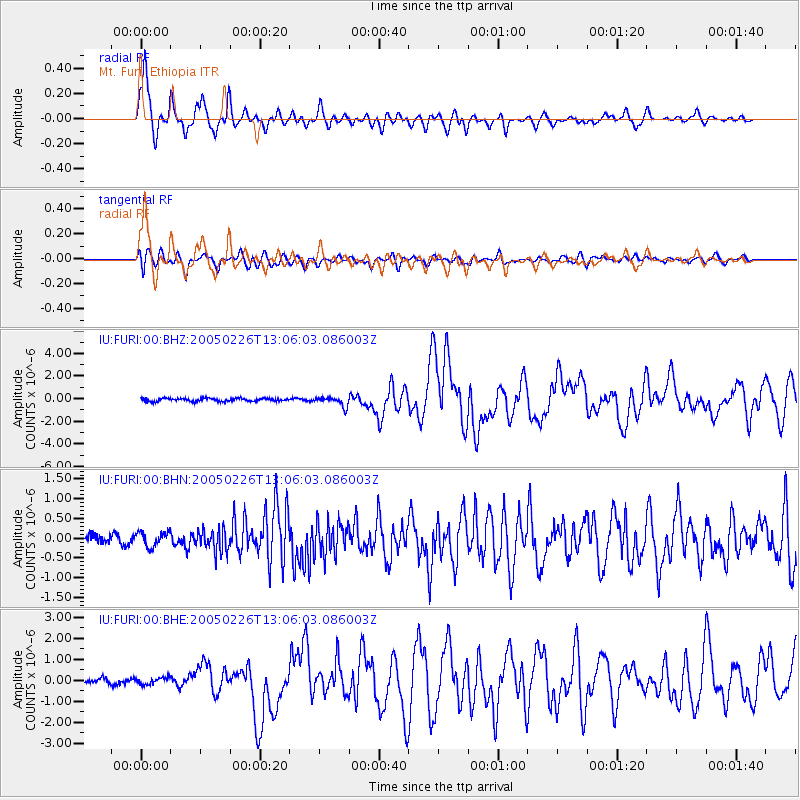
Earthquake location: Off W Coast Of Northern Sumatra
Earthquake latitude/longitude: 2.9/95.6
Earthquake time(UTC): 2005/02/26 (057) 12:56:52 GMT
Earthquake Depth: 36 km
Earthquake Magnitude: 6.0 MB, 6.7 MS, 6.8 MW, 6.7 MW
Earthquake Catalog/Contributor: WHDF/NEIC
Network: IU Global Seismograph Network (GSN - IRIS/USGS)
Station: FURI Mt. Furi, Ethiopia
Lat/Lon: 8.90 N/38.68 E
Elevation: 2570 m
Distance: 56.9 deg
Az: 278.67 deg
Baz: 92.324 deg
Ray Param: 0.063788965
Estimated Moho Depth: 69.75 km
Estimated Crust Vp/Vs: 1.93
Assumed Crust Vp: 6.464 km/s
Estimated Crust Vs: 3.353 km/s
Estimated Crust Poisson's Ratio: 0.32
Radial Match: 91.089005 %
Radial Bump: 400
Transverse Match: 79.910706 %
Transverse Bump: 400
SOD ConfigId: 2455
Insert Time: 2010-03-03 16:24:43.889 +0000
GWidth: 2.5
Max Bumps: 400
Tol: 0.001

Signal To Noise

ChannelStoNSTALTA
IU:FURI:00:BHN:20050226T13:06:03.086003Z1.19921881.987335E-71.6571913E-7
IU:FURI:00:BHE:20050226T13:06:03.086003Z1.31813731.6297538E-71.2364067E-7
IU:FURI:00:BHZ:20050226T13:06:03.086003Z3.01649334.1771696E-71.3847766E-7
Arrivals
Ps10 SECOND
PpPs30 SECOND
PsPs/PpSs41 SECOND