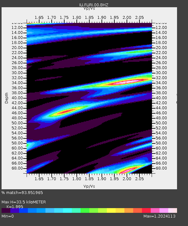
FURI Mt. Furi, Ethiopia - Earthquake Result Viewer
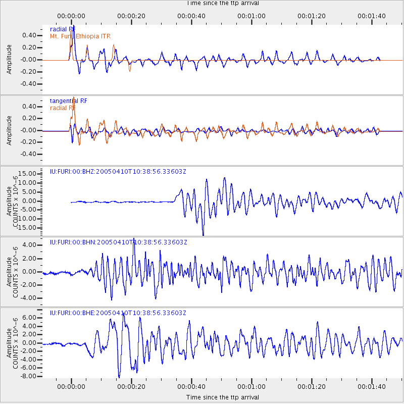
Earthquake location: Southern Sumatra, Indonesia
Earthquake latitude/longitude: -1.6/99.6
Earthquake time(UTC): 2005/04/10 (100) 10:29:11 GMT
Earthquake Depth: 19 km
Earthquake Magnitude: 6.4 MB, 6.7 MS, 6.7 MW, 6.6 MW
Earthquake Catalog/Contributor: WHDF/NEIC
Network: IU Global Seismograph Network (GSN - IRIS/USGS)
Station: FURI Mt. Furi, Ethiopia
Lat/Lon: 8.90 N/38.68 E
Elevation: 2570 m
Distance: 61.6 deg
Az: 280.959 deg
Baz: 96.709 deg
Ray Param: 0.06074924
Estimated Moho Depth: 33.5 km
Estimated Crust Vp/Vs: 2.00
Assumed Crust Vp: 6.464 km/s
Estimated Crust Vs: 3.24 km/s
Estimated Crust Poisson's Ratio: 0.33
Radial Match: 93.951965 %
Radial Bump: 400
Transverse Match: 86.88366 %
Transverse Bump: 400
SOD ConfigId: 2459
Insert Time: 2010-03-03 16:24:50.683 +0000
GWidth: 2.5
Max Bumps: 400
Tol: 0.001

Signal To Noise

ChannelStoNSTALTA
IU:FURI:00:BHN:20050410T10:38:56.33603Z1.22115412.459621E-72.0141773E-7
IU:FURI:00:BHE:20050410T10:38:56.33603Z1.38100772.0565909E-71.489196E-7
IU:FURI:00:BHZ:20050410T10:38:56.33603Z3.10714825.8105036E-71.8700439E-7
Arrivals
Ps5.4 SECOND
PpPs15 SECOND
PsPs/PpSs20 SECOND