FURI Mt. Furi, Ethiopia - Earthquake Result Viewer
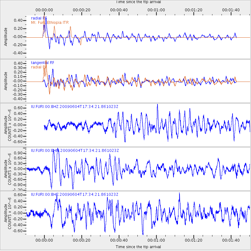
Earthquake location: Prince Edward Islands Region
Earthquake latitude/longitude: -45.8/35.1
Earthquake time(UTC): 2009/06/04 (155) 17:25:25 GMT
Earthquake Depth: 16 km
Earthquake Magnitude: 5.5 MB, 5.7 MS, 6.0 MW, 6.0 MW
Earthquake Catalog/Contributor: WHDF/NEIC
Network: IU Global Seismograph Network (GSN - IRIS/USGS)
Station: FURI Mt. Furi, Ethiopia
Lat/Lon: 8.90 N/38.68 E
Elevation: 2570 m
Distance: 54.6 deg
Az: 4.295 deg
Baz: 183.038 deg
Ray Param: 0.06535168
Estimated Moho Depth: 13.75 km
Estimated Crust Vp/Vs: 1.60
Assumed Crust Vp: 6.464 km/s
Estimated Crust Vs: 4.04 km/s
Estimated Crust Poisson's Ratio: 0.18
Radial Match: 84.91792 %
Radial Bump: 400
Transverse Match: 76.81567 %
Transverse Bump: 400
SOD ConfigId: 2648
Insert Time: 2010-03-03 16:25:08.144 +0000
GWidth: 2.5
Max Bumps: 400
Tol: 0.001

Signal To Noise

ChannelStoNSTALTA
IU:FURI:00:BHN:20090604T17:34:21.861023Z6.0783214.4803866E-77.371092E-8
IU:FURI:00:BHE:20090604T17:34:21.861023Z1.73690321.6725595E-79.6295494E-8
IU:FURI:00:BHZ:20090604T17:34:21.861023Z1.37113921.2500988E-79.117227E-8
Arrivals
Ps1.4 SECOND
PpPs5.2 SECOND
PsPs/PpSs6.6 SECOND