FURI Mt. Furi, Ethiopia - Earthquake Result Viewer
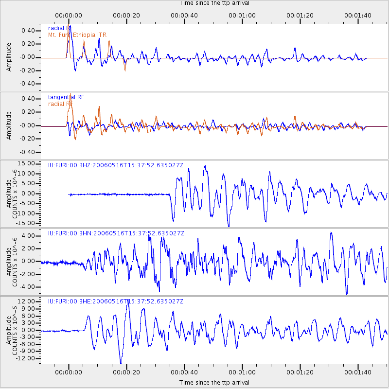
Earthquake location: Northern Sumatra, Indonesia
Earthquake latitude/longitude: 0.1/97.1
Earthquake time(UTC): 2006/05/16 (136) 15:28:25 GMT
Earthquake Depth: 12 km
Earthquake Magnitude: 6.6 MB, 6.8 MS, 6.8 MW, 6.8 MW
Earthquake Catalog/Contributor: WHDF/NEIC
Network: IU Global Seismograph Network (GSN - IRIS/USGS)
Station: FURI Mt. Furi, Ethiopia
Lat/Lon: 8.90 N/38.68 E
Elevation: 2570 m
Distance: 58.8 deg
Az: 280.292 deg
Baz: 95.299 deg
Ray Param: 0.06262239
Estimated Moho Depth: 69.5 km
Estimated Crust Vp/Vs: 1.94
Assumed Crust Vp: 6.464 km/s
Estimated Crust Vs: 3.332 km/s
Estimated Crust Poisson's Ratio: 0.32
Radial Match: 90.94588 %
Radial Bump: 400
Transverse Match: 82.44599 %
Transverse Bump: 400
SOD ConfigId: 2669
Insert Time: 2010-03-03 16:25:27.398 +0000
GWidth: 2.5
Max Bumps: 400
Tol: 0.001

Signal To Noise

ChannelStoNSTALTA
IU:FURI:00:BHN:20060516T15:37:52.635027Z1.40125983.2222283E-72.2995225E-7
IU:FURI:00:BHE:20060516T15:37:52.635027Z1.8902082.3192636E-71.2269886E-7
IU:FURI:00:BHZ:20060516T15:37:52.635027Z0.987689851.4455289E-71.4635454E-7
Arrivals
Ps11 SECOND
PpPs30 SECOND
PsPs/PpSs41 SECOND