You are here: Home > Network List > TA - USArray Transportable Network (new EarthScope stations) Stations List
> Station L44A Lake County Forest Preserve, Grayslake, IL, USA > Earthquake Result Viewer
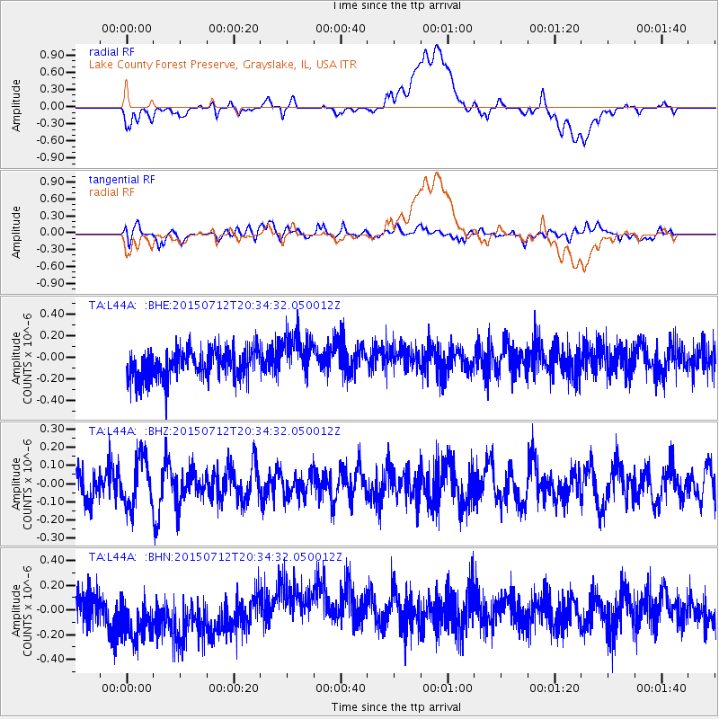
L44A Lake County Forest Preserve, Grayslake, IL, USA - Earthquake Result Viewer
*The percent match for this event was below the threshold and hence no stack was calculated.
| Earthquake location: |
Kuril Islands |
| Earthquake latitude/longitude: |
45.9/151.8 |
| Earthquake time(UTC): |
2015/07/12 (193) 20:23:18 GMT |
| Earthquake Depth: |
100 km |
| Earthquake Magnitude: |
4.4 mb |
| Earthquake Catalog/Contributor: |
ISC/ISC |
|
| Network: |
TA USArray Transportable Network (new EarthScope stations) |
| Station: |
L44A Lake County Forest Preserve, Grayslake, IL, USA |
| Lat/Lon: |
42.18 N/87.91 W |
| Elevation: |
202 m |
|
| Distance: |
77.5 deg |
| Az: |
41.086 deg |
| Baz: |
321.899 deg |
| Ray Param: |
$rayparam |
*The percent match for this event was below the threshold and hence was not used in the summary stack. |
|
| Radial Match: |
35.6033 % |
| Radial Bump: |
400 |
| Transverse Match: |
47.91332 % |
| Transverse Bump: |
400 |
| SOD ConfigId: |
7422571 |
| Insert Time: |
2019-04-19 19:16:05.829 +0000 |
| GWidth: |
2.5 |
| Max Bumps: |
400 |
| Tol: |
0.001 |
|
Signal To Noise
| Channel | StoN | STA | LTA |
| TA:L44A: :BHZ:20150712T20:34:32.050012Z | 1.5208956 | 1.3599154E-7 | 8.941543E-8 |
| TA:L44A: :BHN:20150712T20:34:32.050012Z | 1.8398757 | 2.752685E-7 | 1.4961255E-7 |
| TA:L44A: :BHE:20150712T20:34:32.050012Z | 1.6478863 | 2.2400724E-7 | 1.3593609E-7 |
| Arrivals |
| Ps | |
| PpPs | |
| PsPs/PpSs | |


