FURI Mt. Furi, Ethiopia - Earthquake Result Viewer
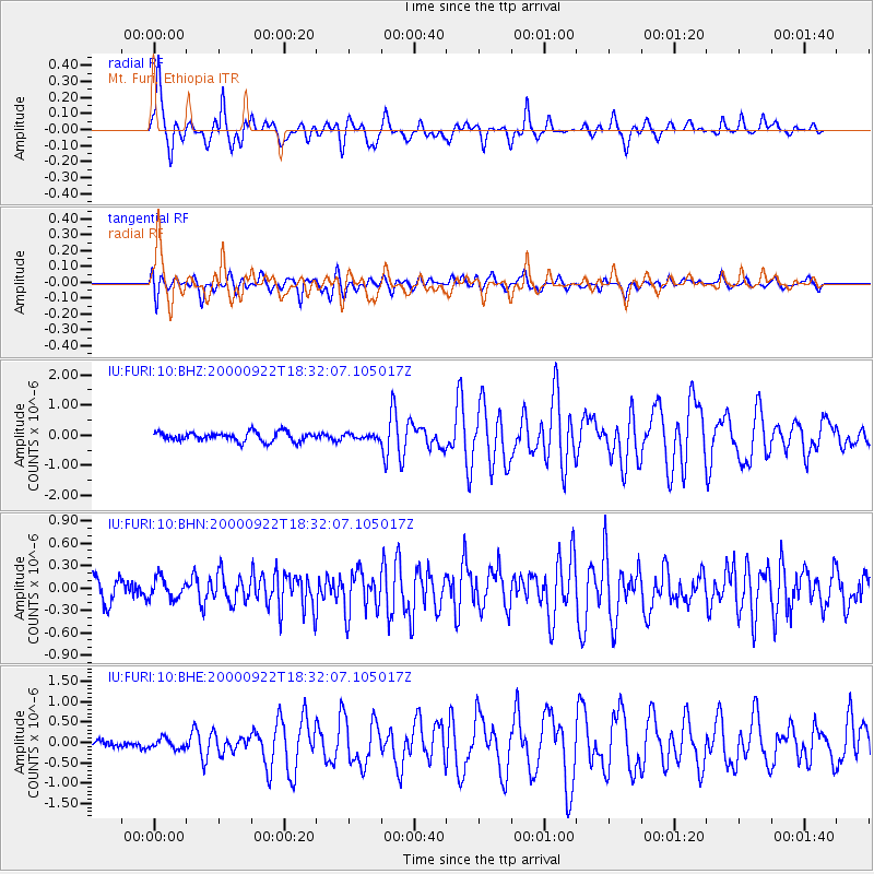
Earthquake location: Southern Sumatra, Indonesia
Earthquake latitude/longitude: -5.0/102.1
Earthquake time(UTC): 2000/09/22 (266) 18:22:03 GMT
Earthquake Depth: 33 km
Earthquake Magnitude: 5.8 MB, 5.9 MS, 6.2 MW, 6.2 MW
Earthquake Catalog/Contributor: WHDF/NEIC
Network: IU Global Seismograph Network (GSN - IRIS/USGS)
Station: FURI Mt. Furi, Ethiopia
Lat/Lon: 8.90 N/38.68 E
Elevation: 2570 m
Distance: 64.7 deg
Az: 282.199 deg
Baz: 99.769 deg
Ray Param: 0.058696974
Estimated Moho Depth: 10.0 km
Estimated Crust Vp/Vs: 1.60
Assumed Crust Vp: 6.464 km/s
Estimated Crust Vs: 4.04 km/s
Estimated Crust Poisson's Ratio: 0.18
Radial Match: 91.85311 %
Radial Bump: 368
Transverse Match: 78.74742 %
Transverse Bump: 400
SOD ConfigId: 3744
Insert Time: 2010-03-03 16:25:52.430 +0000
GWidth: 2.5
Max Bumps: 400
Tol: 0.001

Signal To Noise

ChannelStoNSTALTA
IU:FURI:10:BHN:20000922T18:32:07.105017Z0.892081441.385551E-71.5531664E-7
IU:FURI:10:BHE:20000922T18:32:07.105017Z1.03837541.2245103E-71.1792559E-7
IU:FURI:10:BHZ:20000922T18:32:07.105017Z0.492133477.5044866E-81.5248885E-7
Arrivals
Ps1.0 SECOND
PpPs3.8 SECOND
PsPs/PpSs4.8 SECOND