You are here: Home > Network List > IU - Global Seismograph Network (GSN - IRIS/USGS) Stations List
> Station FURI Mt. Furi, Ethiopia > Earthquake Result Viewer
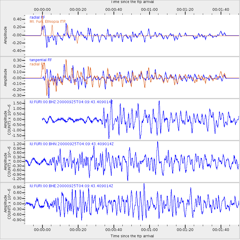
FURI Mt. Furi, Ethiopia - Earthquake Result Viewer
*The percent match for this event was below the threshold and hence no stack was calculated.
| Earthquake location: |
Prince Edward Islands Region |
| Earthquake latitude/longitude: |
-46.8/37.6 |
| Earthquake time(UTC): |
2000/09/25 (269) 04:00:39 GMT |
| Earthquake Depth: |
10 km |
| Earthquake Magnitude: |
5.6 MB, 5.6 MS, 5.9 MW, 5.9 MW |
| Earthquake Catalog/Contributor: |
WHDF/NEIC |
|
| Network: |
IU Global Seismograph Network (GSN - IRIS/USGS) |
| Station: |
FURI Mt. Furi, Ethiopia |
| Lat/Lon: |
8.90 N/38.68 E |
| Elevation: |
2570 m |
|
| Distance: |
55.5 deg |
| Az: |
1.307 deg |
| Baz: |
180.909 deg |
| Ray Param: |
$rayparam |
*The percent match for this event was below the threshold and hence was not used in the summary stack. |
|
| Radial Match: |
83.23615 % |
| Radial Bump: |
400 |
| Transverse Match: |
78.1599 % |
| Transverse Bump: |
400 |
| SOD ConfigId: |
3753 |
| Insert Time: |
2010-03-03 16:26:00.378 +0000 |
| GWidth: |
2.5 |
| Max Bumps: |
400 |
| Tol: |
0.001 |
|
Signal To Noise
| Channel | StoN | STA | LTA |
| IU:FURI:00:BHN:20000925T04:09:43.409014Z | 0.85916775 | 1.2812578E-7 | 1.4912777E-7 |
| IU:FURI:00:BHE:20000925T04:09:43.409014Z | 1.210799 | 1.3834557E-7 | 1.14259734E-7 |
| IU:FURI:00:BHZ:20000925T04:09:43.409014Z | 2.2217135 | 2.9643013E-7 | 1.334241E-7 |
| Arrivals |
| Ps | |
| PpPs | |
| PsPs/PpSs | |


