FURI Mt. Furi, Ethiopia - Earthquake Result Viewer
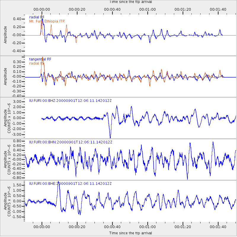
Earthquake location: Off W Coast Of Northern Sumatra
Earthquake latitude/longitude: 1.4/96.6
Earthquake time(UTC): 2000/09/01 (245) 11:56:51 GMT
Earthquake Depth: 33 km
Earthquake Magnitude: 5.6 MB, 6.0 MS, 6.2 MW, 6.0 MW
Earthquake Catalog/Contributor: WHDF/NEIC
Network: IU Global Seismograph Network (GSN - IRIS/USGS)
Station: FURI Mt. Furi, Ethiopia
Lat/Lon: 8.90 N/38.68 E
Elevation: 2570 m
Distance: 58.1 deg
Az: 279.526 deg
Baz: 93.847 deg
Ray Param: 0.06301395
Estimated Moho Depth: 68.0 km
Estimated Crust Vp/Vs: 1.97
Assumed Crust Vp: 6.464 km/s
Estimated Crust Vs: 3.277 km/s
Estimated Crust Poisson's Ratio: 0.33
Radial Match: 85.52519 %
Radial Bump: 385
Transverse Match: 71.30581 %
Transverse Bump: 400
SOD ConfigId: 3744
Insert Time: 2010-03-03 16:26:38.989 +0000
GWidth: 2.5
Max Bumps: 400
Tol: 0.001

Signal To Noise

ChannelStoNSTALTA
IU:FURI:00:BHN:20000901T12:06:11.142012Z0.797258441.18145486E-71.481897E-7
IU:FURI:00:BHE:20000901T12:06:11.142012Z0.894803171.2413992E-71.3873432E-7
IU:FURI:00:BHZ:20000901T12:06:11.142012Z0.53335879.642668E-81.8079142E-7
Arrivals
Ps11 SECOND
PpPs30 SECOND
PsPs/PpSs41 SECOND