You are here: Home > Network List > TA - USArray Transportable Network (new EarthScope stations) Stations List
> Station I23K Minto, Yukon-Koyukuk, AK, USA > Earthquake Result Viewer
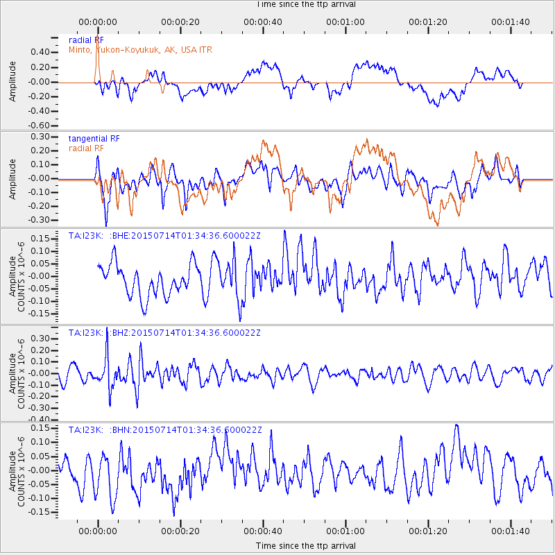
I23K Minto, Yukon-Koyukuk, AK, USA - Earthquake Result Viewer
*The percent match for this event was below the threshold and hence no stack was calculated.
| Earthquake location: |
Near Coast Of Michoacan, Mexico |
| Earthquake latitude/longitude: |
18.2/-103.5 |
| Earthquake time(UTC): |
2015/07/14 (195) 01:25:30 GMT |
| Earthquake Depth: |
14 km |
| Earthquake Magnitude: |
4.9 MW |
| Earthquake Catalog/Contributor: |
ISC/ISC |
|
| Network: |
TA USArray Transportable Network (new EarthScope stations) |
| Station: |
I23K Minto, Yukon-Koyukuk, AK, USA |
| Lat/Lon: |
65.15 N/149.36 W |
| Elevation: |
149 m |
|
| Distance: |
55.9 deg |
| Az: |
338.496 deg |
| Baz: |
124.463 deg |
| Ray Param: |
$rayparam |
*The percent match for this event was below the threshold and hence was not used in the summary stack. |
|
| Radial Match: |
42.119984 % |
| Radial Bump: |
400 |
| Transverse Match: |
51.00066 % |
| Transverse Bump: |
400 |
| SOD ConfigId: |
7422571 |
| Insert Time: |
2019-04-19 19:25:02.192 +0000 |
| GWidth: |
2.5 |
| Max Bumps: |
400 |
| Tol: |
0.001 |
|
Signal To Noise
| Channel | StoN | STA | LTA |
| TA:I23K: :BHZ:20150714T01:34:36.600022Z | 2.4032176 | 1.3885548E-7 | 5.777899E-8 |
| TA:I23K: :BHN:20150714T01:34:36.600022Z | 1.4484822 | 9.53929E-8 | 6.5857144E-8 |
| TA:I23K: :BHE:20150714T01:34:36.600022Z | 1.2634405 | 7.606956E-8 | 6.0208265E-8 |
| Arrivals |
| Ps | |
| PpPs | |
| PsPs/PpSs | |


