You are here: Home > Network List > IU - Global Seismograph Network (GSN - IRIS/USGS) Stations List
> Station FURI Mt. Furi, Ethiopia > Earthquake Result Viewer
FURI Mt. Furi, Ethiopia - Earthquake Result Viewer
*The percent match for this event was below the threshold and hence no stack was calculated.
| Earthquake location: |
Sichuan, China |
| Earthquake latitude/longitude: |
31.3/104.7 |
| Earthquake time(UTC): |
2008/05/12 (133) 06:42:08 GMT |
| Earthquake Depth: |
10 km |
| Earthquake Magnitude: |
5.7 MB |
| Earthquake Catalog/Contributor: |
WHDF/NEIC |
|
| Network: |
IU Global Seismograph Network (GSN - IRIS/USGS) |
| Station: |
FURI Mt. Furi, Ethiopia |
| Lat/Lon: |
8.90 N/38.68 E |
| Elevation: |
2570 m |
|
| Distance: |
65.0 deg |
| Az: |
265.152 deg |
| Baz: |
59.633 deg |
| Ray Param: |
$rayparam |
*The percent match for this event was below the threshold and hence was not used in the summary stack. |
|
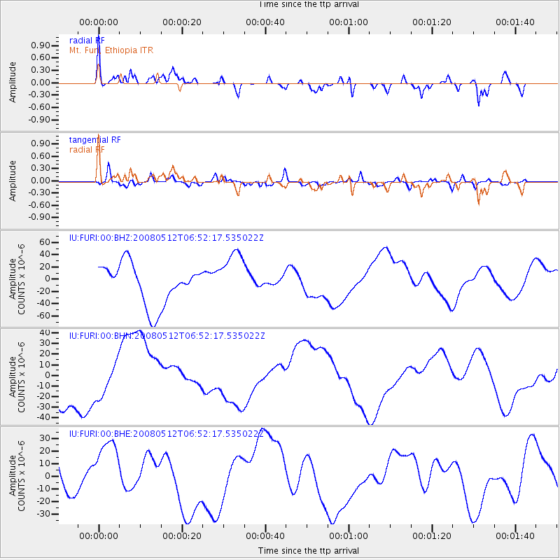
| Radial Match: |
68.37946 % |
| Radial Bump: |
388 |
| Transverse Match: |
50.916637 % |
| Transverse Bump: |
400 |
| SOD ConfigId: |
2504 |
| Insert Time: |
2010-03-03 16:27:15.089 +0000 |
| GWidth: |
2.5 |
| Max Bumps: |
400 |
| Tol: |
0.001 |
|
Signal To Noise
| Channel | StoN | STA | LTA |
| IU:FURI:00:BHN:20080512T06:52:17.535022Z | 0.8126508 | 1.7041635E-5 | 2.0970427E-5 |
| IU:FURI:00:BHE:20080512T06:52:17.535022Z | 1.7372121 | 2.602512E-5 | 1.4980968E-5 |
| IU:FURI:00:BHZ:20080512T06:52:17.535022Z | 1.3171378 | 4.310763E-5 | 3.2728258E-5 |
| Arrivals |
| Ps | |
| PpPs | |
| PsPs/PpSs | |


