You are here: Home > Network List > GS - US Geological Survey Networks Stations List
> Station KAN11 Stewart Ranch, Harper County, KS, USA > Earthquake Result Viewer
KAN11 Stewart Ranch, Harper County, KS, USA - Earthquake Result Viewer
*The percent match for this event was below the threshold and hence no stack was calculated.
| Earthquake location: |
Off East Coast Of Honshu, Japan |
| Earthquake latitude/longitude: |
39.6/143.6 |
| Earthquake time(UTC): |
2015/02/17 (048) 16:33:21 GMT |
| Earthquake Depth: |
10 km |
| Earthquake Magnitude: |
5.5 MWW, 5.5 MWC, 5.5 MWB |
| Earthquake Catalog/Contributor: |
NEIC PDE/NEIC COMCAT |
|
| Network: |
GS US Geological Survey Networks |
| Station: |
KAN11 Stewart Ranch, Harper County, KS, USA |
| Lat/Lon: |
37.21 N/97.91 W |
| Elevation: |
410 m |
|
| Distance: |
85.0 deg |
| Az: |
44.775 deg |
| Baz: |
317.014 deg |
| Ray Param: |
$rayparam |
*The percent match for this event was below the threshold and hence was not used in the summary stack. |
|
| Radial Match: |
26.226034 % |
| Radial Bump: |
400 |
| Transverse Match: |
31.975729 % |
| Transverse Bump: |
400 |
| SOD ConfigId: |
872571 |
| Insert Time: |
2015-03-22 21:05:29.232 +0000 |
| GWidth: |
2.5 |
| Max Bumps: |
400 |
| Tol: |
0.001 |
|
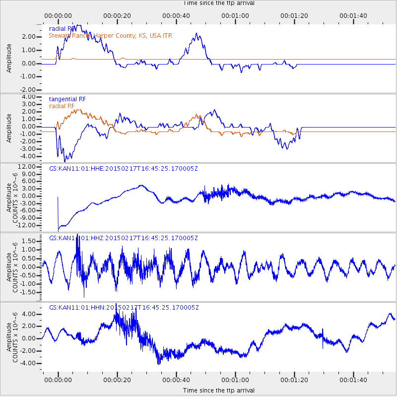
Signal To Noise
| Channel | StoN | STA | LTA |
| GS:KAN11:01:HHZ:20150217T16:45:25.170005Z | 2.105963 | 6.812619E-7 | 3.2349186E-7 |
| GS:KAN11:01:HHN:20150217T16:45:25.170005Z | 0.65936005 | 1.2284306E-6 | 1.863065E-6 |
| GS:KAN11:01:HHE:20150217T16:45:25.170005Z | 1.2574415 | 5.7586362E-6 | 4.5796455E-6 |
| Arrivals |
| Ps | |
| PpPs | |
| PsPs/PpSs | |


