You are here: Home > Network List > IU - Global Seismograph Network (GSN - IRIS/USGS) Stations List
> Station FURI Mt. Furi, Ethiopia > Earthquake Result Viewer
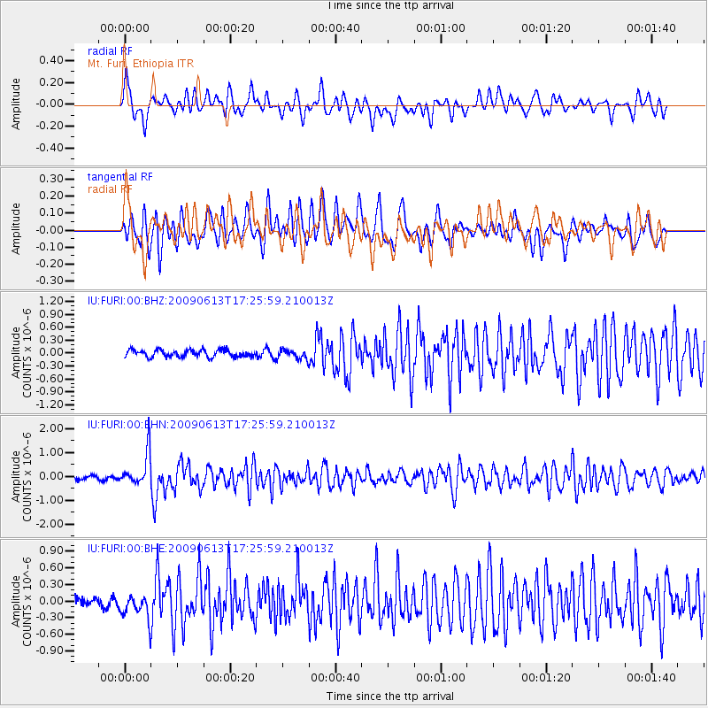
FURI Mt. Furi, Ethiopia - Earthquake Result Viewer
*The percent match for this event was below the threshold and hence no stack was calculated.
| Earthquake location: |
Eastern Kazakhstan |
| Earthquake latitude/longitude: |
44.7/78.9 |
| Earthquake time(UTC): |
2009/06/13 (164) 17:17:38 GMT |
| Earthquake Depth: |
14 km |
| Earthquake Magnitude: |
5.8 MB, 5.1 MS, 5.4 MW, 5.4 MW |
| Earthquake Catalog/Contributor: |
WHDF/NEIC |
|
| Network: |
IU Global Seismograph Network (GSN - IRIS/USGS) |
| Station: |
FURI Mt. Furi, Ethiopia |
| Lat/Lon: |
8.90 N/38.68 E |
| Elevation: |
2570 m |
|
| Distance: |
49.8 deg |
| Az: |
236.631 deg |
| Baz: |
37.049 deg |
| Ray Param: |
$rayparam |
*The percent match for this event was below the threshold and hence was not used in the summary stack. |
|
| Radial Match: |
65.08747 % |
| Radial Bump: |
400 |
| Transverse Match: |
63.22173 % |
| Transverse Bump: |
400 |
| SOD ConfigId: |
2648 |
| Insert Time: |
2010-03-03 16:27:41.848 +0000 |
| GWidth: |
2.5 |
| Max Bumps: |
400 |
| Tol: |
0.001 |
|
Signal To Noise
| Channel | StoN | STA | LTA |
| IU:FURI:00:BHN:20090613T17:25:59.210013Z | 10.545264 | 7.1102005E-7 | 6.742553E-8 |
| IU:FURI:00:BHE:20090613T17:25:59.210013Z | 1.6423365 | 2.1945766E-7 | 1.3362526E-7 |
| IU:FURI:00:BHZ:20090613T17:25:59.210013Z | 1.3074162 | 1.0673481E-7 | 8.163797E-8 |
| Arrivals |
| Ps | |
| PpPs | |
| PsPs/PpSs | |


