You are here: Home > Network List > IU - Global Seismograph Network (GSN - IRIS/USGS) Stations List
> Station FURI Mt. Furi, Ethiopia > Earthquake Result Viewer
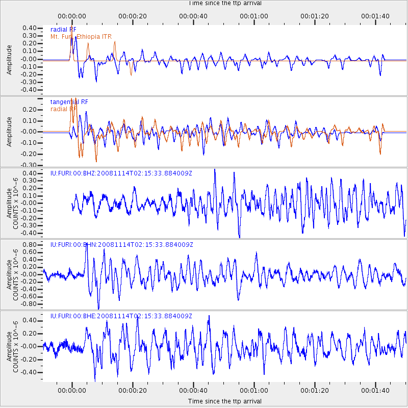
FURI Mt. Furi, Ethiopia - Earthquake Result Viewer
*The percent match for this event was below the threshold and hence no stack was calculated.
| Earthquake location: |
Bouvet Island Region |
| Earthquake latitude/longitude: |
-53.8/8.7 |
| Earthquake time(UTC): |
2008/11/14 (319) 02:05:09 GMT |
| Earthquake Depth: |
12 km |
| Earthquake Magnitude: |
5.7 MB, 5.5 MS, 5.9 MW, 5.9 MW |
| Earthquake Catalog/Contributor: |
WHDF/NEIC |
|
| Network: |
IU Global Seismograph Network (GSN - IRIS/USGS) |
| Station: |
FURI Mt. Furi, Ethiopia |
| Lat/Lon: |
8.90 N/38.68 E |
| Elevation: |
2570 m |
|
| Distance: |
67.4 deg |
| Az: |
32.303 deg |
| Baz: |
198.714 deg |
| Ray Param: |
$rayparam |
*The percent match for this event was below the threshold and hence was not used in the summary stack. |
|
| Radial Match: |
64.58381 % |
| Radial Bump: |
400 |
| Transverse Match: |
60.997322 % |
| Transverse Bump: |
400 |
| SOD ConfigId: |
2658 |
| Insert Time: |
2010-03-03 16:28:02.019 +0000 |
| GWidth: |
2.5 |
| Max Bumps: |
400 |
| Tol: |
0.001 |
|
Signal To Noise
| Channel | StoN | STA | LTA |
| IU:FURI:00:BHN:20081114T02:15:33.884009Z | 3.2744856 | 2.517686E-7 | 7.688798E-8 |
| IU:FURI:00:BHE:20081114T02:15:33.884009Z | 1.1330873 | 9.129901E-8 | 8.057545E-8 |
| IU:FURI:00:BHZ:20081114T02:15:33.884009Z | 0.93371457 | 8.04047E-8 | 8.611272E-8 |
| Arrivals |
| Ps | |
| PpPs | |
| PsPs/PpSs | |


