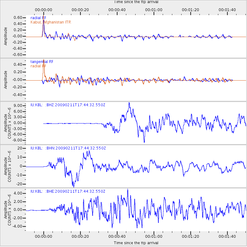
KBL Kabul, Afghanistan - Earthquake Result Viewer
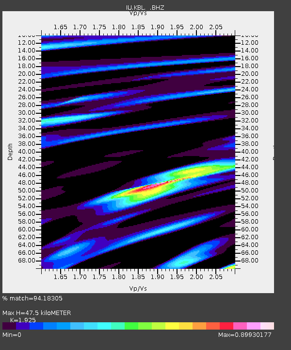
Earthquake location: Talaud Islands, Indonesia
Earthquake latitude/longitude: 3.9/126.4
Earthquake time(UTC): 2009/02/11 (042) 17:34:50 GMT
Earthquake Depth: 22 km
Earthquake Magnitude: 6.6 MB, 7.2 MS, 7.2 MW, 7.1 MW
Earthquake Catalog/Contributor: WHDF/NEIC
Network: IU Global Seismograph Network (GSN - IRIS/USGS)
Station: KBL Kabul, Afghanistan
Lat/Lon: 34.54 N/69.04 E
Elevation: 1920 m
Distance: 61.2 deg
Az: 307.49 deg
Baz: 106.461 deg
Ray Param: 0.06102359
Estimated Moho Depth: 47.5 km
Estimated Crust Vp/Vs: 1.92
Assumed Crust Vp: 6.641 km/s
Estimated Crust Vs: 3.45 km/s
Estimated Crust Poisson's Ratio: 0.32
Radial Match: 94.18305 %
Radial Bump: 400
Transverse Match: 84.18269 %
Transverse Bump: 400
SOD ConfigId: 2658
Insert Time: 2010-03-03 16:28:16.575 +0000
GWidth: 2.5
Max Bumps: 400
Tol: 0.001

Signal To Noise

ChannelStoNSTALTA
IU:KBL: :BHN:20090211T17:44:32.550Z22.3735981.9212034E-68.586922E-8
IU:KBL: :BHE:20090211T17:44:32.550Z3.36992031.3682296E-74.060125E-8
IU:KBL: :BHZ:20090211T17:44:32.550Z20.8420288.499786E-74.0781956E-8
Arrivals
Ps6.9 SECOND
PpPs20 SECOND
PsPs/PpSs27 SECOND