
KBL Kabul, Afghanistan - Earthquake Result Viewer
| ||||||||||||||||||
| ||||||||||||||||||
| ||||||||||||||||||
|
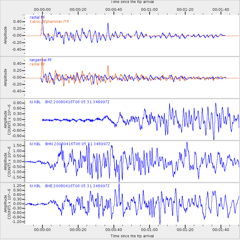
Signal To Noise
| Channel | StoN | STA | LTA |
| IU:KBL: :BHN:20080416T06:05:31.348997Z | 7.7136674 | 2.1939178E-7 | 2.8441956E-8 |
| IU:KBL: :BHE:20080416T06:05:31.348997Z | 3.106131 | 9.249114E-8 | 2.977696E-8 |
| IU:KBL: :BHZ:20080416T06:05:31.348997Z | 1.955258 | 6.0709525E-8 | 3.1049368E-8 |
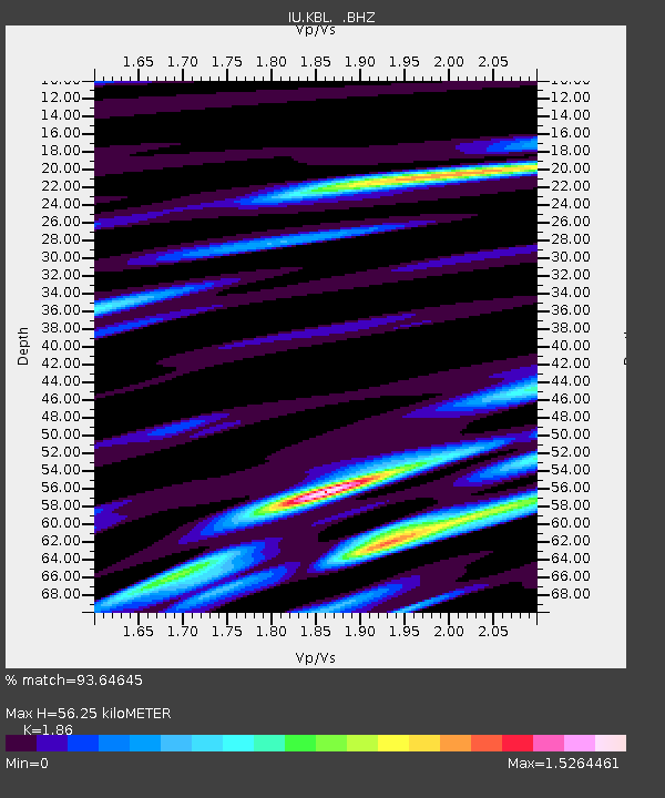
| Arrivals | |
| Ps | 7.5 SECOND |
| PpPs | 23 SECOND |
| PsPs/PpSs | 31 SECOND |

