You are here: Home > Network List > GS - US Geological Survey Networks Stations List
> Station KAN10 Keim Farm > Earthquake Result Viewer
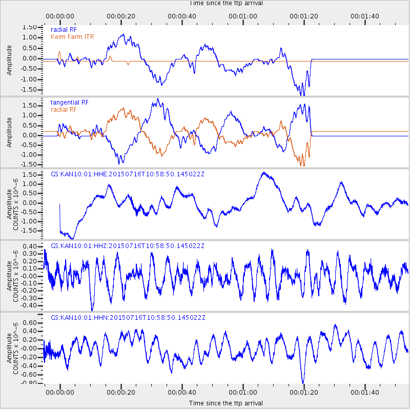
KAN10 Keim Farm - Earthquake Result Viewer
*The percent match for this event was below the threshold and hence no stack was calculated.
| Earthquake location: |
Near Coast Of Central Chile |
| Earthquake latitude/longitude: |
-29.5/-71.8 |
| Earthquake time(UTC): |
2015/07/16 (197) 10:48:05 GMT |
| Earthquake Depth: |
12 km |
| Earthquake Magnitude: |
5.2 MW |
| Earthquake Catalog/Contributor: |
ISC/ISC |
|
| Network: |
GS US Geological Survey Networks |
| Station: |
KAN10 Keim Farm |
| Lat/Lon: |
37.12 N/98.10 W |
| Elevation: |
417 m |
|
| Distance: |
70.7 deg |
| Az: |
337.954 deg |
| Baz: |
155.837 deg |
| Ray Param: |
$rayparam |
*The percent match for this event was below the threshold and hence was not used in the summary stack. |
|
| Radial Match: |
41.770805 % |
| Radial Bump: |
400 |
| Transverse Match: |
30.754019 % |
| Transverse Bump: |
400 |
| SOD ConfigId: |
7422571 |
| Insert Time: |
2019-04-19 19:50:44.398 +0000 |
| GWidth: |
2.5 |
| Max Bumps: |
400 |
| Tol: |
0.001 |
|
Signal To Noise
| Channel | StoN | STA | LTA |
| GS:KAN10:01:HHZ:20150716T10:58:50.145022Z | 0.70627254 | 1.0606446E-7 | 1.5017497E-7 |
| GS:KAN10:01:HHN:20150716T10:58:50.145022Z | 1.0035765 | 2.2132875E-7 | 2.2053999E-7 |
| GS:KAN10:01:HHE:20150716T10:58:50.145022Z | 0.38592735 | 3.276916E-7 | 8.4910175E-7 |
| Arrivals |
| Ps | |
| PpPs | |
| PsPs/PpSs | |


