KBL Kabul, Afghanistan - Earthquake Result Viewer
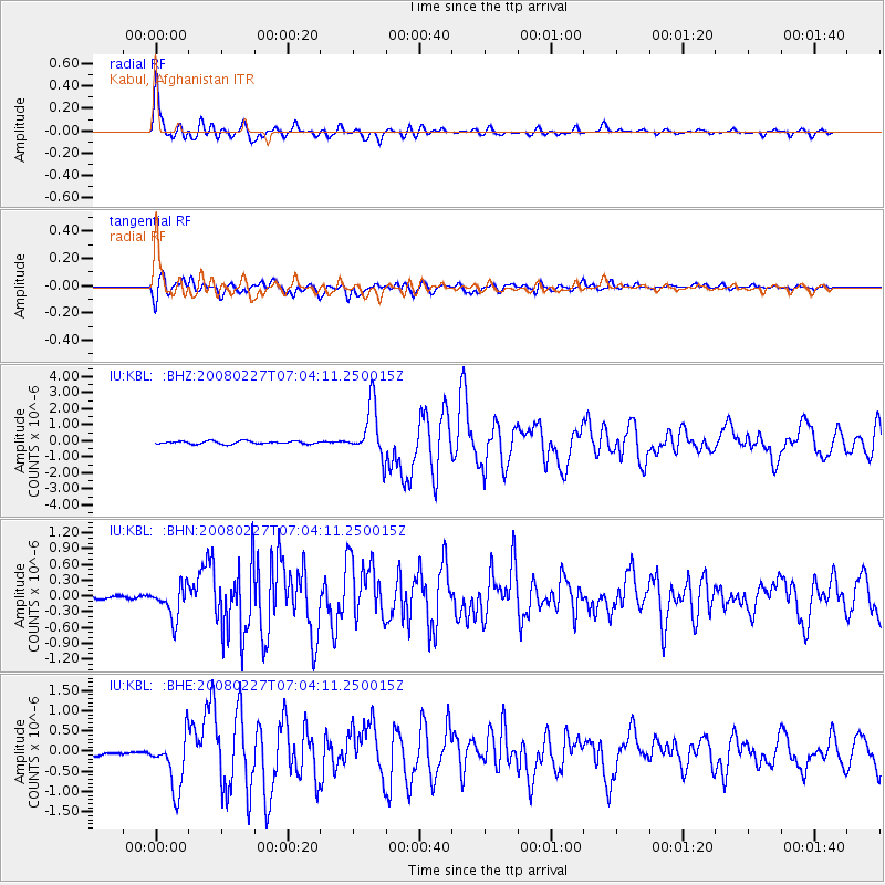
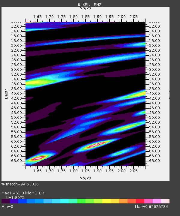
Earthquake location: Bonin Islands, Japan Region
Earthquake latitude/longitude: 26.8/142.4
Earthquake time(UTC): 2008/02/27 (058) 06:54:20 GMT
Earthquake Depth: 15 km
Earthquake Magnitude: 5.8 MB, 6.1 MS, 6.2 MW, 6.2 MW
Earthquake Catalog/Contributor: WHDF/NEIC
Network: IU Global Seismograph Network (GSN - IRIS/USGS)
Station: KBL Kabul, Afghanistan
Lat/Lon: 34.54 N/69.04 E
Elevation: 1920 m
Distance: 62.3 deg
Az: 296.739 deg
Baz: 75.2 deg
Ray Param: 0.060273893
Estimated Moho Depth: 61.0 km
Estimated Crust Vp/Vs: 1.90
Assumed Crust Vp: 6.641 km/s
Estimated Crust Vs: 3.5 km/s
Estimated Crust Poisson's Ratio: 0.31
Radial Match: 94.53026 %
Radial Bump: 400
Transverse Match: 87.13897 %
Transverse Bump: 400
SOD ConfigId: 2564
Insert Time: 2010-03-03 16:30:09.202 +0000
GWidth: 2.5
Max Bumps: 400
Tol: 0.001

Signal To Noise

ChannelStoNSTALTA
IU:KBL: :BHN:20080227T07:04:11.250015Z6.1307263.0842062E-75.030736E-8
IU:KBL: :BHE:20080227T07:04:11.250015Z15.9153326.6524694E-74.1799122E-8
IU:KBL: :BHZ:20080227T07:04:11.250015Z17.4925981.6197757E-69.259778E-8
Arrivals
Ps8.6 SECOND
PpPs25 SECOND
PsPs/PpSs34 SECOND