You are here: Home > Network List > TA - USArray Transportable Network (new EarthScope stations) Stations List
> Station Z41A Richland Creek Farm, El Dorado, AR, USA > Earthquake Result Viewer
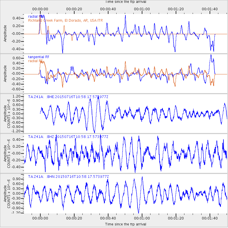
Z41A Richland Creek Farm, El Dorado, AR, USA - Earthquake Result Viewer
*The percent match for this event was below the threshold and hence no stack was calculated.
| Earthquake location: |
Near Coast Of Central Chile |
| Earthquake latitude/longitude: |
-29.5/-71.8 |
| Earthquake time(UTC): |
2015/07/16 (197) 10:48:05 GMT |
| Earthquake Depth: |
12 km |
| Earthquake Magnitude: |
5.2 MW |
| Earthquake Catalog/Contributor: |
ISC/ISC |
|
| Network: |
TA USArray Transportable Network (new EarthScope stations) |
| Station: |
Z41A Richland Creek Farm, El Dorado, AR, USA |
| Lat/Lon: |
33.26 N/92.80 W |
| Elevation: |
62 m |
|
| Distance: |
65.5 deg |
| Az: |
340.715 deg |
| Baz: |
159.906 deg |
| Ray Param: |
$rayparam |
*The percent match for this event was below the threshold and hence was not used in the summary stack. |
|
| Radial Match: |
52.063717 % |
| Radial Bump: |
400 |
| Transverse Match: |
42.15424 % |
| Transverse Bump: |
400 |
| SOD ConfigId: |
7422571 |
| Insert Time: |
2019-04-19 19:54:02.659 +0000 |
| GWidth: |
2.5 |
| Max Bumps: |
400 |
| Tol: |
0.001 |
|
Signal To Noise
| Channel | StoN | STA | LTA |
| TA:Z41A: :BHZ:20150716T10:58:17.573977Z | 0.55868196 | 1.6547543E-7 | 2.9618897E-7 |
| TA:Z41A: :BHN:20150716T10:58:17.573977Z | 0.94588774 | 3.1926442E-7 | 3.3752886E-7 |
| TA:Z41A: :BHE:20150716T10:58:17.573977Z | 2.3947093 | 8.688096E-7 | 3.6280377E-7 |
| Arrivals |
| Ps | |
| PpPs | |
| PsPs/PpSs | |


