
KBL Kabul, Afghanistan - Earthquake Result Viewer
| ||||||||||||||||||
| ||||||||||||||||||
| ||||||||||||||||||
|
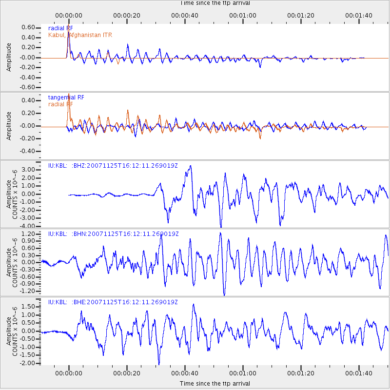
Signal To Noise
| Channel | StoN | STA | LTA |
| IU:KBL: :BHN:20071125T16:12:11.269019Z | 5.424793 | 2.6835528E-7 | 4.9468298E-8 |
| IU:KBL: :BHE:20071125T16:12:11.269019Z | 6.51862 | 4.974333E-7 | 7.63096E-8 |
| IU:KBL: :BHZ:20071125T16:12:11.269019Z | 14.01305 | 1.4345778E-6 | 1.02374415E-7 |
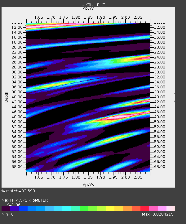
| Arrivals | |
| Ps | 7.2 SECOND |
| PpPs | 20 SECOND |
| PsPs/PpSs | 28 SECOND |

